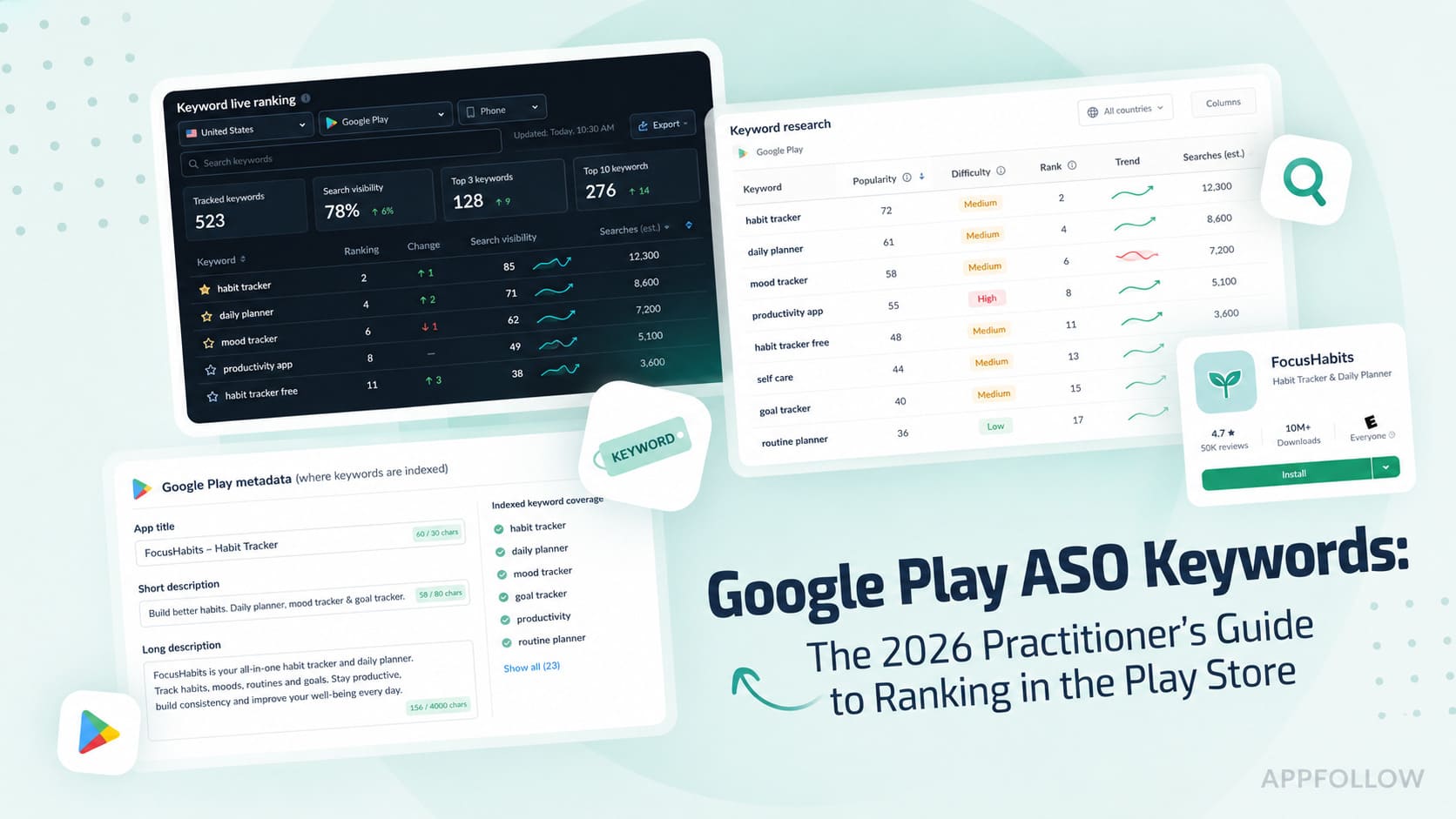
Ratings & Reviews performance provides an overview of what users think of your app. Here are the key metrics to help you identify how your app is rated by users and how successful is your review management strategy.
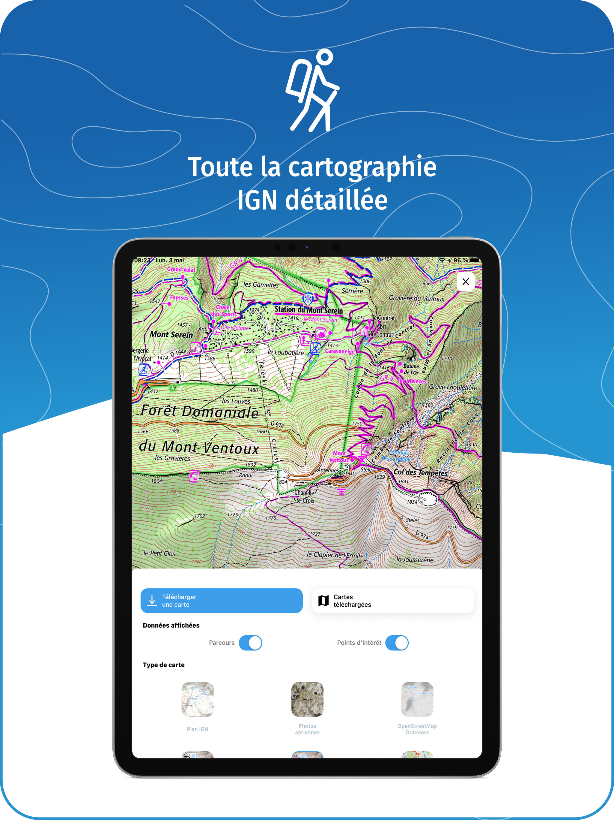
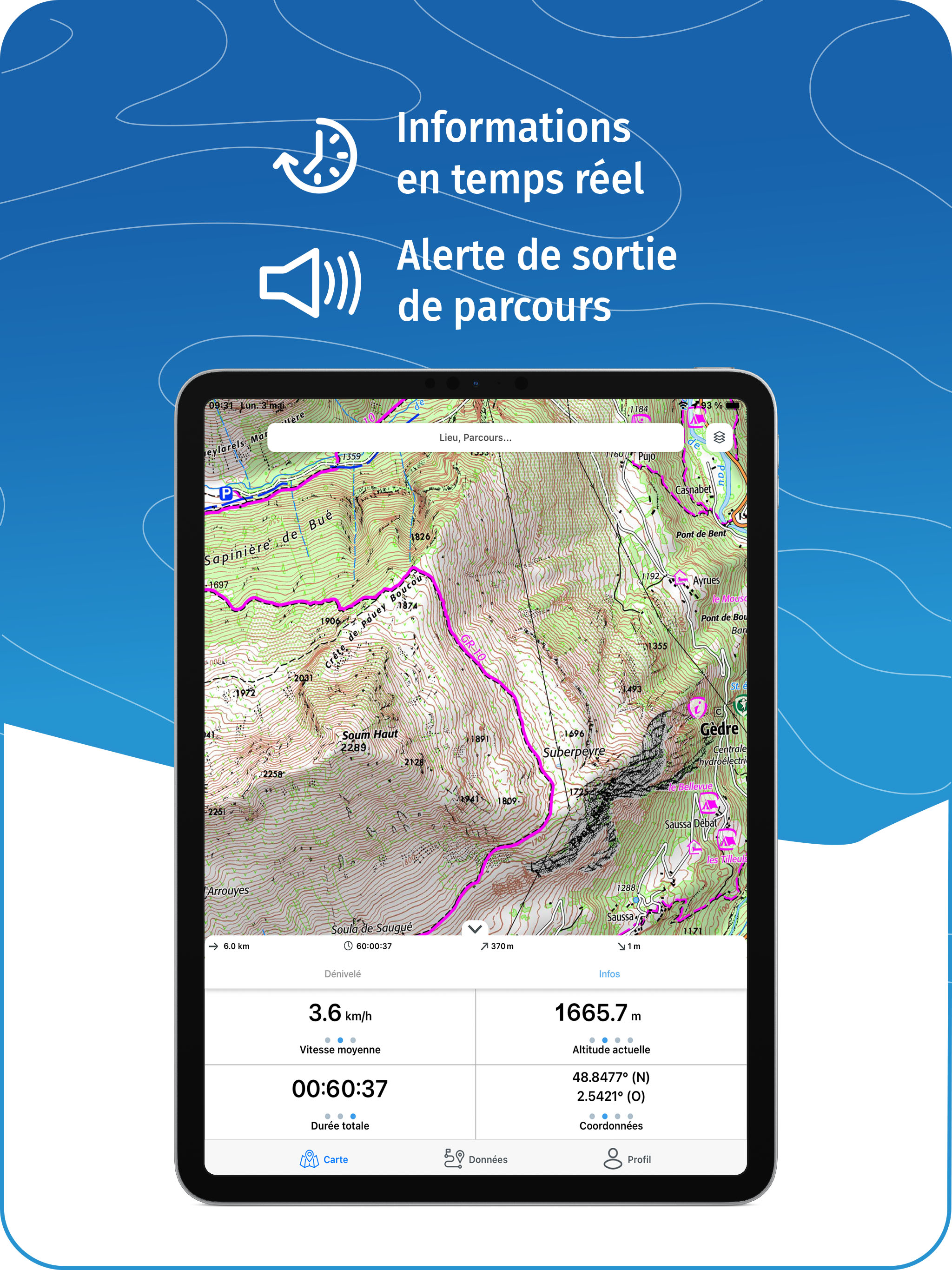
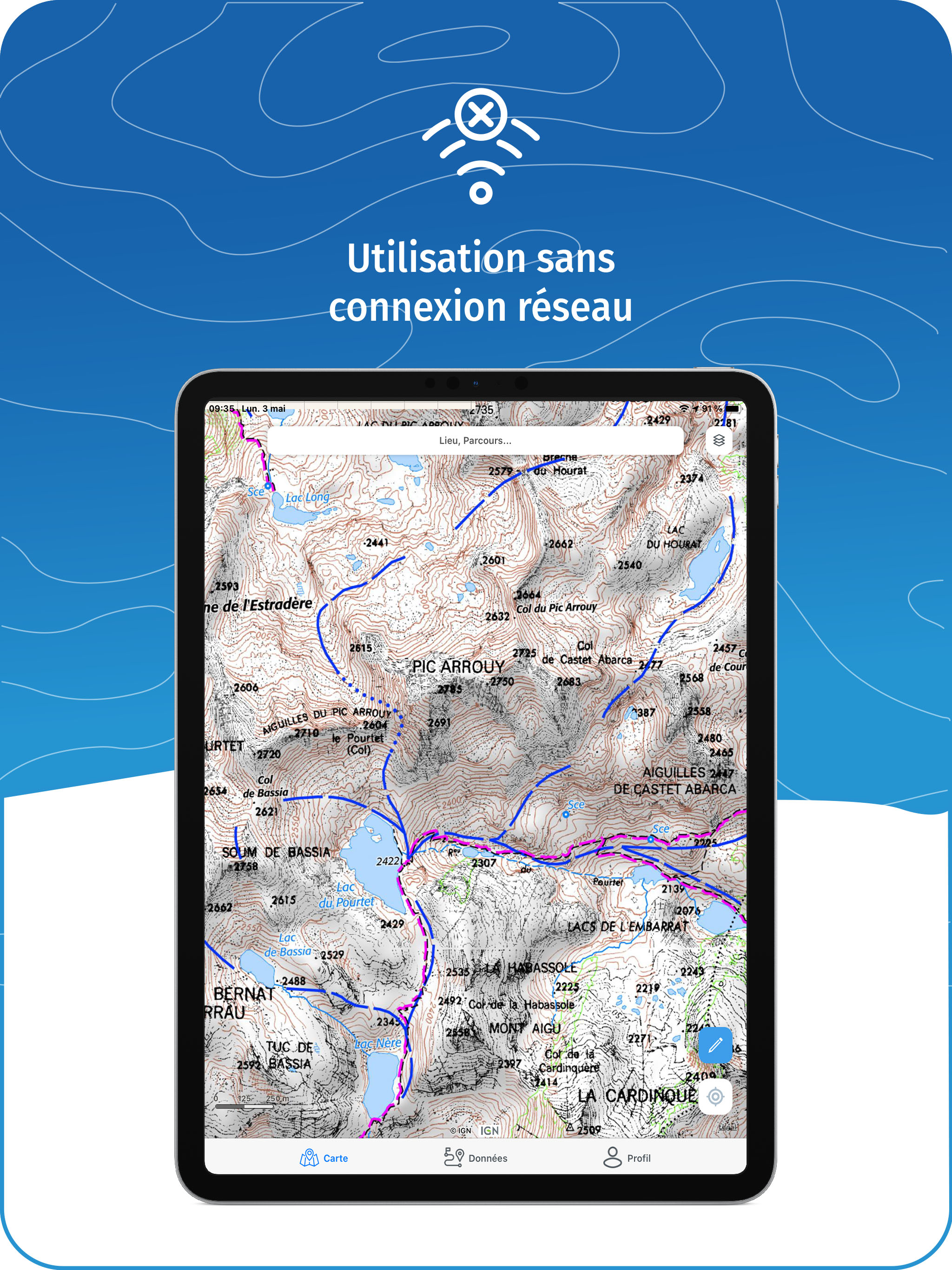
WeTrek (ex IGNrando') is a platform for sharing routes and points of interest related to outdoor activities. MAPS & LAYERS IN FREE ACCESS (with internet connection) • Plan IGN: most updated map, suitable for all activities • Aerial photos (IGN) • OpenStreetMap Outdoors: world map with hiking routes & contour lines • OpenCycleMap: world map with cycling routes & contour lines ∙ Spain IGN map ∙ Swisstopo map ∙ Emergency calls (112) mobile network coverage map for France ∙ Winter trails (in collaboration with the Petzl Foundation) ∙ OpenSnowMap GPS GUIDING ALONG ROUTES • See your progression on the map and on the elevation profile • Get alerted if you exit the route GPS TRACKING AND DATA CREATION • Record your own routes using GPS • Quickly create routes on-device with the automatic routing tool that follows roads and paths (online only, with subscription) • Create Points of interest • Export Routes or Points to save them locally (Files app) or share them • Send your routes to ignrando.fr for backup or to publish them OFFLINE USE • The GPS keeps working even without internet: see your position on the map, use GPS guiding and record routes • Downloaded routes: descriptions, photos and guiding remain accessible • Downloaded maps (with subscription) USEFUL TIP: Enabling Airplane Mode or disabling Mobile Data improves battery life, without affecting the Location Services (GPS) GET MORE with the WeTrek Plus Subscription • Create routes with pedestrian and vehicle routing • View & download the following maps & layers: ∙ All free version maps ∙ IGN maps (various scales) ∙ IGN 1:25k topo maps (Top 25): the famous French topographical maps available at all zoom levels ∙ 1950 IGN maps ∙ Military maps (1820-1866) ∙ ICAO aeronautical charts ∙ France mobile network operators coverage maps ∙ Slopes > 30° (useful for winter activites) ∙ Cadastral parcels layer ∙ DFCI grid (forest fire protection grid) • Drones flight restriction areas ∙ Roads & paths layer (only available with Aerial photos) Subscription purchased on the App Store - 3-day free trial on first subscription - Billed to your App Store account - Auto-renewable WARNING: Only Apple can refund IGNrando' Plus subscriptions purchased on the App Store Apple Terms of Use (EULA) apply: https://www.apple.com/legal/internet-services/itunes/dev/stdeula/ Subscription purchased on the Ubicarta shop (wetrek.ubicarta.com) - Linked to Ubicarta account - Auto-renewable - Can be used simultaneously on 3 devices Subscription purchased on Au Vieux Campeur shop (auvieuxcampeur.fr) - Linked to Au Vieux Campeur account - No auto-renewal - Can be used simultaneously on 3 devices Terms of service: https://wt.gy/terms Privacy policy: https://wt.gy/privacy