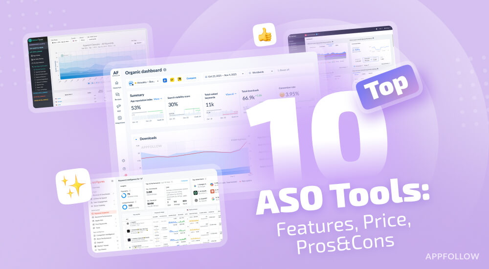
Ratings & Reviews performance provides an overview of what users think of your app. Here are the key metrics to help you identify how your app is rated by users and how successful is your review management strategy.
User reviews affect conversion to installs and app rating. Featured and helpful reviews are the first to be noticed by users and in case of no response can affect download rate.
This is the best tool for those working in surveying, mapping, construction, transportation, planning... It supports high precision GPS and Glonass navigation in fieldwork surveys. This tool is designed for Civil Engineer, Surveyor, Civil Surveyor, Land Surveying and Topografia The typical functions of Super GeoGPS: 1 - Available many common reference systems, allows to set up more other reference systems. 2 - Easy to finding waypoint on any reference coordinate systems by display direction, compass, distance, load Google maps. (for Civil Engineer and Surveyor) 3 - Used 7 transformations parameters to automatically convert between Geographic and UTM Coordinates. Synchronize Google map with UTM zone. 4 - Support convert between Geographic and UTM coordinates. Convert UTM coordinates between different zone. 5 - Support GPS and Glonass - Touch on Google map to add point - Geological camera 6- - Fast config - Add all of WGS84 central meridian. 9 - Geodetic coordinates/UTM with: - WGS1984 - WGS1972 - NAD1983/1927 - VN2000/ Hanoi 72 - Austria NS - Belgium 50 - Nouv Trig de France 1