Ratings & Reviews performance provides an overview of what users think of your app. Here are the key metrics to help you identify how your app is rated by users and how successful is your review management strategy.
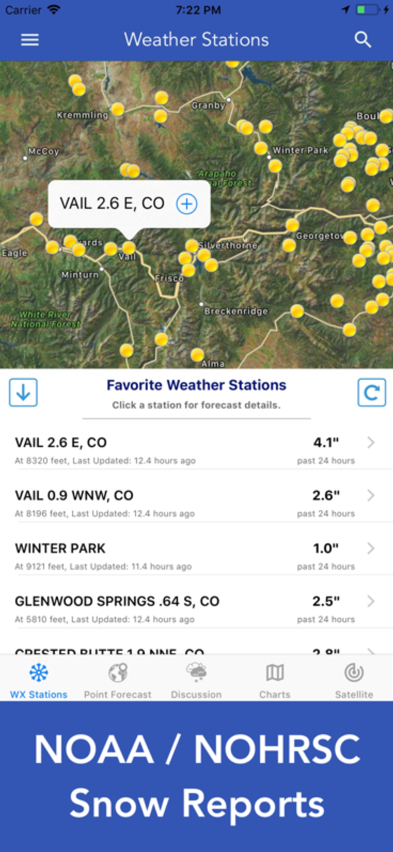
Download the most comprehensive Snow Report and Forecast app for iOS. Features Include: + 7-day NOAA Point & Zone Snow Forecast + 3-day NOHRSC Hourly Snowfall Forecast + GOES-East & GOES-West Satellite Imagery + NWS Weather Forecast Discussion Reports + 16-day NCEP Weather Forecast Models + 3-month Precipitation & Temperature Outlook + GOES Satellite Imagery iOS 14 Widgets + Daily NCDC U.S. Snowfall Reports + NOAA Weather Map Overlays 7-DAY NOAA WEATHER FORECAST - Snowfall Summary, Point & Zone Forecast - Snow Accumulation & Probability - Severe Weather Hazards Simply tap any point on the map for a spot specific snow and weather forecast. 3-DAY HOURLY SNOWFALL & WEATHER FORECAST - Hourly Snowfall - Cumulative Snow Depth - Rainfall - Wind Speed - Air Temperature - Relative Humidity Access NOHRSC data from over 20,000 weather stations that report snowfall and cumulative snow depth. GOES SATELLITE IMAGERY Ten (10) Satellite Imagery Filters - Visible (Band 2) - Near IR (Bands 4 & 5) - Infrared (Bands 7, 8, 9, 10, 13, 14 & 16) NCDC DAILY U.S. SNOWFALL REPORTS - Daily & monthly snowfall totals NOAA WEATHER RADAR Important Note: NOHRSC weather stations are primarily available for the continental USA and Canada. Data is generally not available in Hawaii or Alaska. The 7-day NOAA/NWS Point-Forecast feature is only available for locations in USA territory. If you have questions about data coverage, please email me. — PRO SUBSCRIPTION FEATURES — + 7-day Hourly Weather Forecast + 16-Day Weather Forecast Models + Full Screen, Hi-Res Satellite Imagery + Hi-Res Weather Simulation Models + NOAA Winter Weather Graphics + WPC Precipitation & Temperature Outlook 7-DAY NOAA HOURLY WEATHER FORECAST - Snowfall Accumulation - Probability of Snowfall - Wind Speed, Gust, Direction - Probability of Precipitation - Air Temperature - Cloud Cover - Relative Humidity NOAA WINTER WEATHER GRAPHICS - Expected Snowfall - Percent Chance of X” Snow - Storm Severity Index - Snow Amount - Snow Load - Blowing Snow - Flash Freeze - Ground Blizzard - Ice Accumulation - Expected Ice Accumulation - Significant Surface Low Track - Day 3 Snowfall Accumulation Probability - Day 4-7 Probability of Exceeding X” Snow - Day 8-14 Snow Hazards Outlook FULL SCREEN, HI-RES SATELLITE IMAGERY 16-DAY WEATHER FORECAST MODELS - Global Forecast System (GFS) - Global Ensemble Forecast System (GEFS) - North American Ensemble (NAEFS) WEATHER SIMULATION FORECAST MODELS + Hi-Res Ensemble Forecast (HREF) - Simulated Radar - 1-hour Mean Snow - 3-hour Mean Snow - Mean Snow Total - Probability of Snow - Probability of Snow, > 1” per hour - Probability of Snow, > 1” per 3 hours - Probability of Snow, > 3” per 3 hours - Probability of Sleet - Probability of Freezing Rain + More Weather Models - Hi-Res Rapid Refresh (HRRR) - North American Mesoscale (NAM) - Hi-Res North American Mesoscale (NAM-HIRES) TERMS & CONDITIONS https://lwbrandsllc.com/snow-report-forecast-terms-conditions/ — * Available for iPad and iPhone with single purchase Regional Coverage Includes: - Continental USA - Hawaii - Alaska - Puerto Rico Enjoy!


