Ratings & Reviews performance provides an overview of what users think of your app. Here are the key metrics to help you identify how your app is rated by users and how successful is your review management strategy.
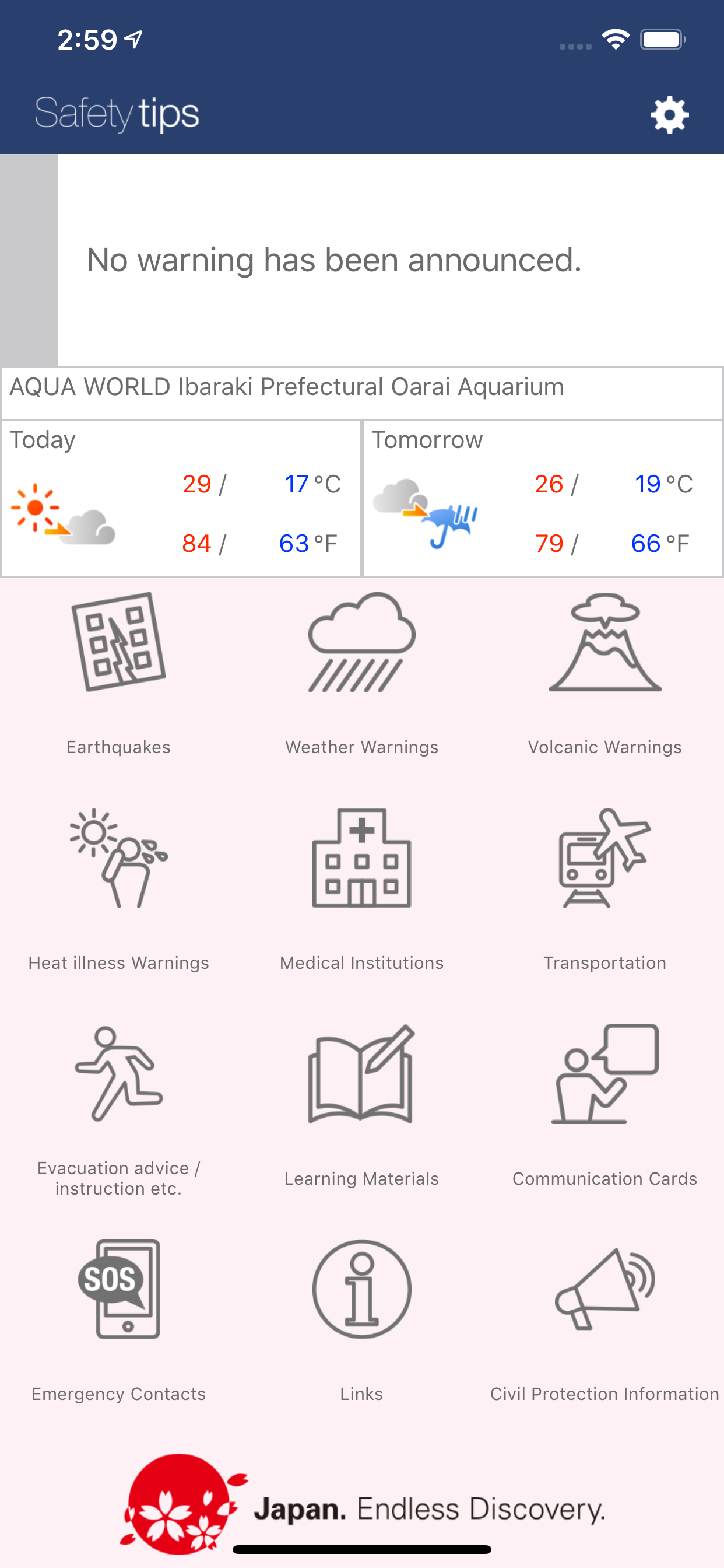
Note: Evacuation advisory and instruction information will not be displayed on the list screen in the application version earlier than 3.1.6. Please update to the latest version of the Safety tips. This Application notifies a user with EEW, Tsunami Warnings, Volcanic Warnings, Weather Warnings, Heat illness Warnings and Civil Protection Information issued in Japan. It is a free application developed under the supervision of Japan Tourism Agency. The Application provides various functions useful for foreign tourists in Japan. The application is available in 12 languages: English, simplified and traditional Chinese, Korean, Spanish, Portuguese, Tagalog, Indonesian, Vietnamese, Nepali, Thai, and Japanese. <Main functions and its utilization> -Receiving Earthquake Early Warnings, Tsunami Warnings, Volcanic Warnings, Weather Warnings, Heat illness Warnings and Civil Protection Information. Before using the Application for the first time, select locations for which you wish to receive warnings from the Settings Menu (you may select a maximum of five locations (in Japan only))(*). Users will receive notifications when Earthquake Early Warning for local earthquakes of seismic intensity level 4 or greater, Tsunami Warning, Volcanic Warnings, Emergency Warnings , Heat illness Warnings, or Civil Protection Information are issued for the selected locations. Also, please make sure that the device which has not been changed a prediction point for more than 1 month from final change date of setting will not be able to receive notifications. If you turn automatic setting of a point on, you can receive notifications even in the case that it has been more than 1 month since you set a prediction point. (*) It is necessary to activate the Location Information Service (GPS), if you wish to set locations by using GPS. GPS is also used to display your current location on the map. -Earthquakes Information on past earthquakes. A maximum of ten records (seismic intensity level of 3 or higher.) -Weather Warnings Weather Warnings (heavy rain, flood, violent wind, severe snowstorm, heavy snow, high seas, storm surge) and Emergency Warnings (heavy rain, violent wind, severe snowstorm, heavy snow, high seas, storm surge) issued for the selected locations. -Volcanic Warnings Currently issued Volcanic Warnings. -Heat illness Warnings Currently issued Heat illness Warnings. -Medical Institutions List of medical facilities accepting foreigners (Provided by the Japan Tourism Agency.) -Evacuation advice / instruction etc. Provides Evacuation advice / instruction information. Also provides Shelter Information. (Link to external application.) ※Please note that information of municipalities using "L alert" will be displayed. -Learning Materials Knowledge you want to know before a disaster occurs. -Communication cards A set of question sentences that can be used when asking questions to people around you during a disaster. -Emergency Contacts Numbers to call in case of emergency. -Links Links to other sources of information that may be necessary during disaster situations (contact information of embassy, nearest tourist information centers, etc.), and other information concerning disasters and tourism. - Civil Protection Information Safety tips delivers information regarding ballistic missile attacks among civil protection information from Fire and Disaster Management Agency. While the application and various types of information are free, communication charges related to download and use of Application shall be borne by the user. We will not be liable for any losses and/or damages resulting from the use of the Application. For support site of Safety tips, see here -> http://www.rcsc.co.jp/safetytips-sp


