Ratings & Reviews performance provides an overview of what users think of your app. Here are the key metrics to help you identify how your app is rated by users and how successful is your review management strategy.
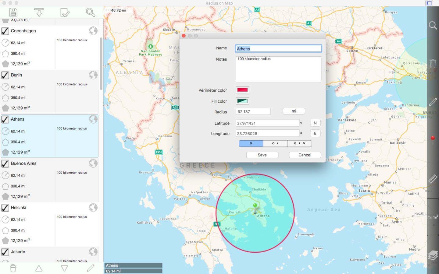
Easily make and edit radii on a map. Properties for each radius: - Center coordinate - Radius - Pin color - Fill color and opacity - Perimeter color and opacity - Name - Notes (optional) Other features: - Import radii stored as polygons in a .kml file. - Export radii as 60 point polygons saved to a kml file to view in Google Earth™ or other mapping applications. - Ability to specify which radii show on the map by selecting them in the list view. - Search for keywords in name and notes fields to find a specific radius. - Show current location on map. This requires WIFI to be on and at least one mapped WIFI network nearby. - Forward geocoding: Find locations on the map by typing an address. - Reverse geocoding: Find addresses near a given point on the map. - Create a new radius from a geocoding result. Coordinate formats include: - Degrees - Degrees, Minutes - Degrees, Minutes, Seconds - UTM (Universal Transverse Mercator) - MGRS (Military Grid Reference System) (Datum used is WGS-84) Distance units include: - Kilometers - Miles - Nautical miles - Meters - Yards - Feet - Custom. Define your own distance units in terms of meters. For example: 1 centimeter = 0.01 meter and 1 kilometer = 1000 meters. Area units include: - Square meters - Square feet - Square yards - Square kilometers - Square miles - Square nautical miles - Acres - Hectares - Custom. Define your own area units in terms of square meters. For example: 1 square centimeter = 0.0001 square meter and 1 square kilometer = 1000000 square meters. Other notes: - Includes undo / redo functionality for important operations such as move, add / delete, and change radius. Please visit the web page for more details.


![How to measure customer sentiment for app reviews [7 metrics]](https://cdn.appfollow.io/blog/static/appfollow_1335e02d-b0b3-49f7-9eb6-94171dc7e379.jpg)