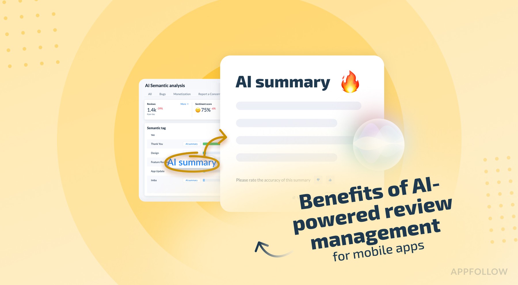
Ratings & Reviews performance provides an overview of what users think of your app. Here are the key metrics to help you identify how your app is rated by users and how successful is your review management strategy.
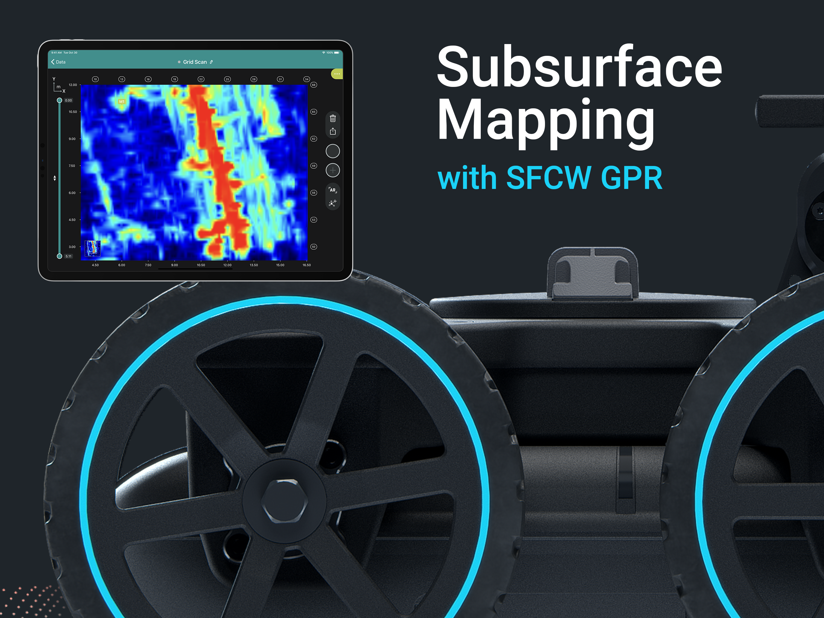
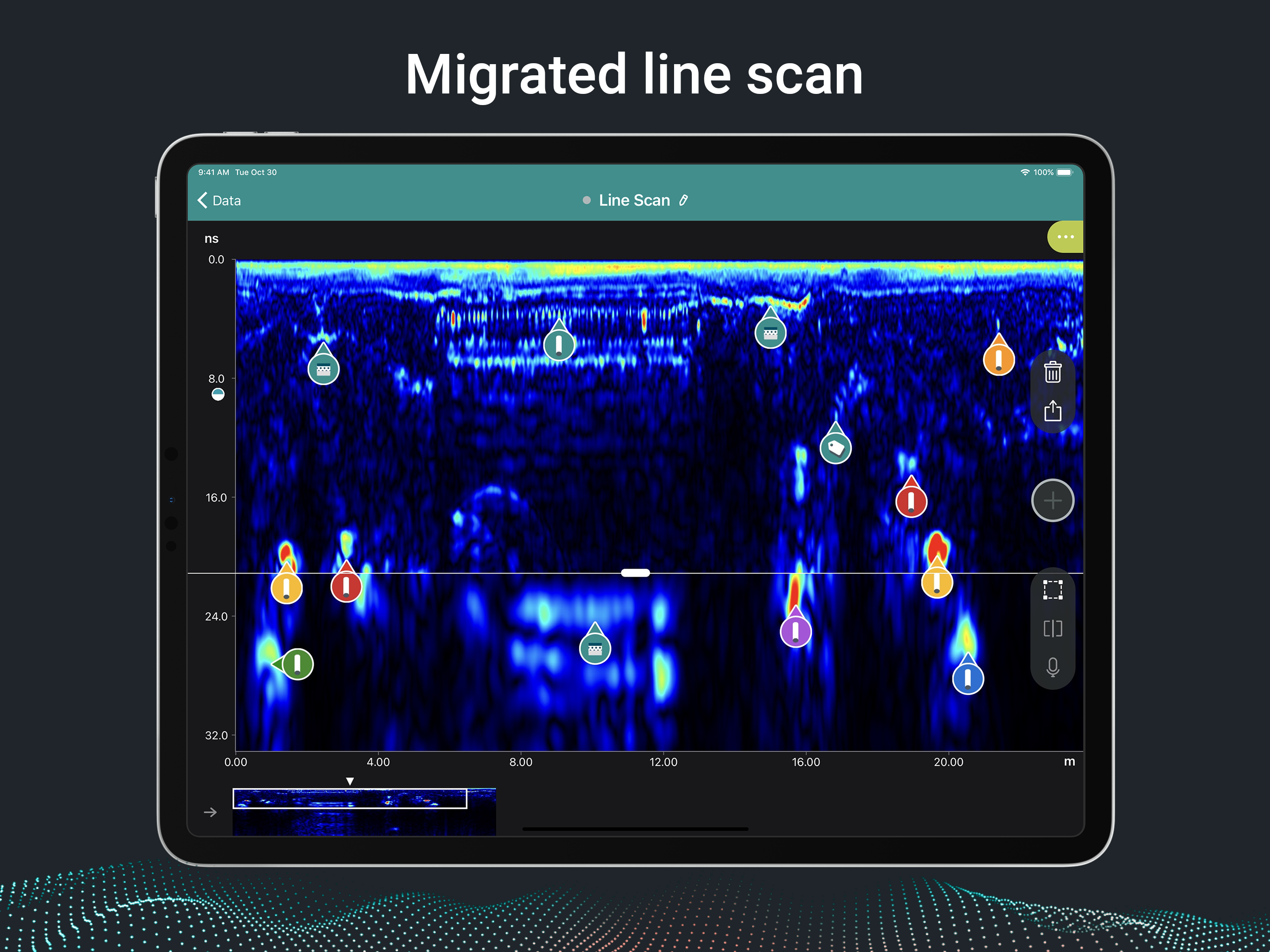
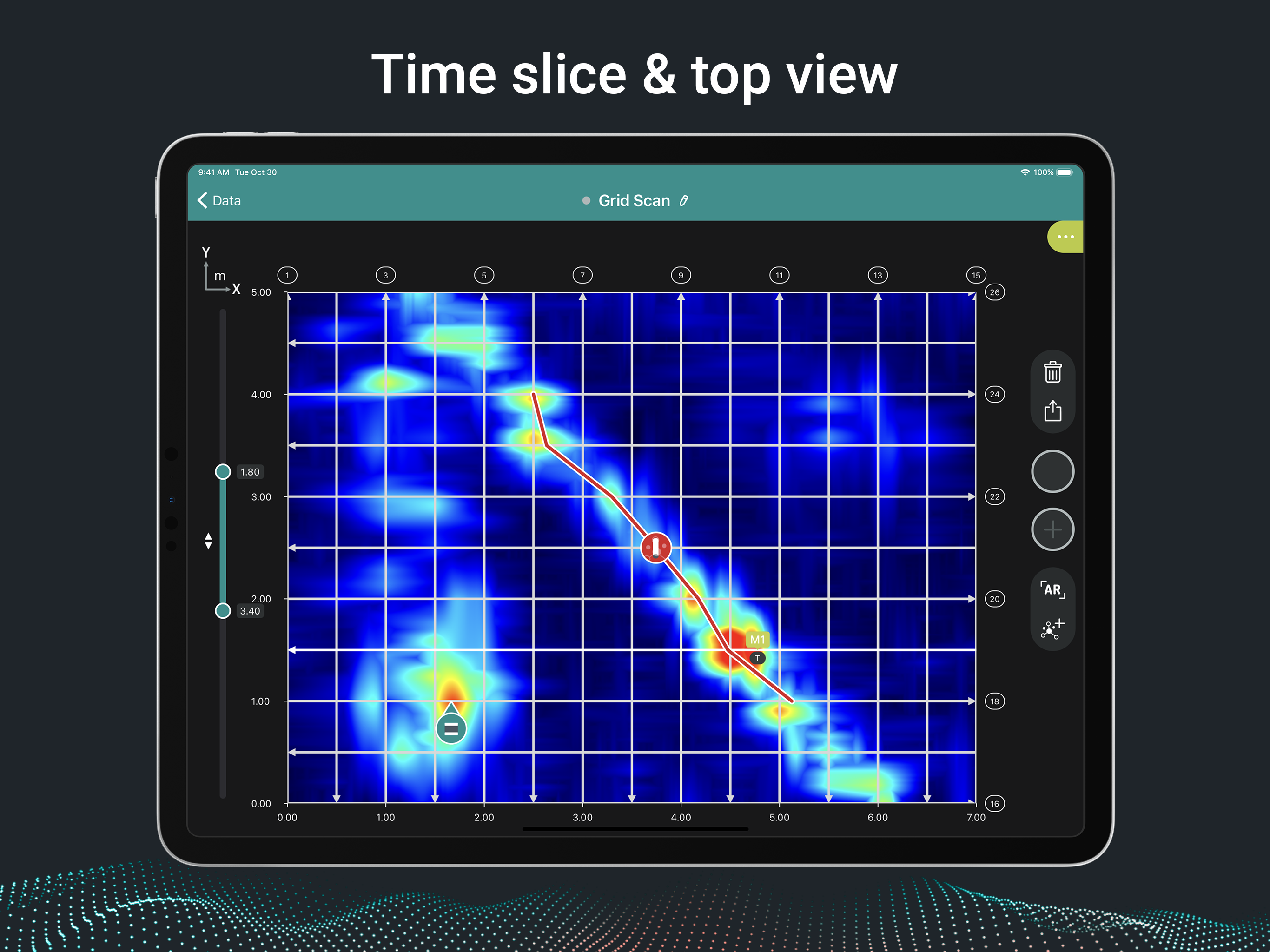
Proceq GPR Subsurface: Powerful sensors with radar beams for subsurface mapping applications. Intelligent software at your fingertips. The mission behind Proceq GPR Subsurface is simple: Scan the undeground to provide a clear 3D image of the subsurface, to detect objects effortlessly and reliably, and to collaborate anywhere, anytime, for utility strike prevention, as-built verification, and structural investigation. The revolutionary Proceq GS8000 is the world’s most advanced subsurface mapping system, equipped with Stepped-Frequency Continuous-Wave (SFCW) technology and precise GNSS positioning. The true-ultrawideband antenna system and Swiss-made, optimized electronics deliver unparalleled resolution and penetration depth—at the same time. The magic starts once you connect the GS8000 wireless to your iPad and fire up the Proceq GPR Subsurface app. The lightning-fast user interface increases your productivity by making measurements and analysis a breeze with intuitive gestures and controls; for example, by switching between real-time radargram and migrated views on the fly. A rich feature set brings advanced workflows on-site, so that you can get more things done while in the field. Annotate your measurements with precise geolocation, tags, photos, voice memos and comments in the logbook. Access and share them with colleagues anywhere, anytime, and export your measurements into the SEG-Y and HTML formats for post-processing and reporting, over the cloud. Detect automatically utility lines with AI assistance and label them accordingly to produce as-built maps. Look deep into subsurface on-site with Time-Slice View and 3D View, and superimpose these views onto the structure with robust, accurate Augmented Reality—an industry first. Download the free app now and explore the state of the art of GPR for underground investigations with the included demo files.