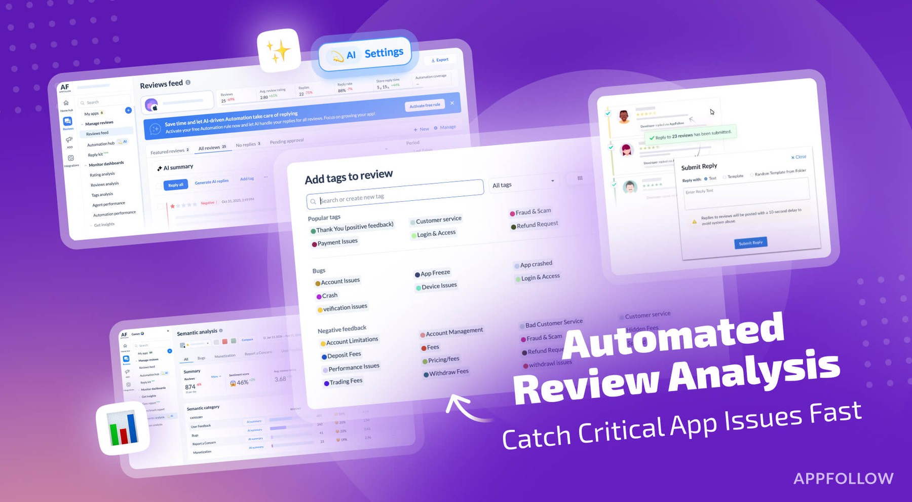
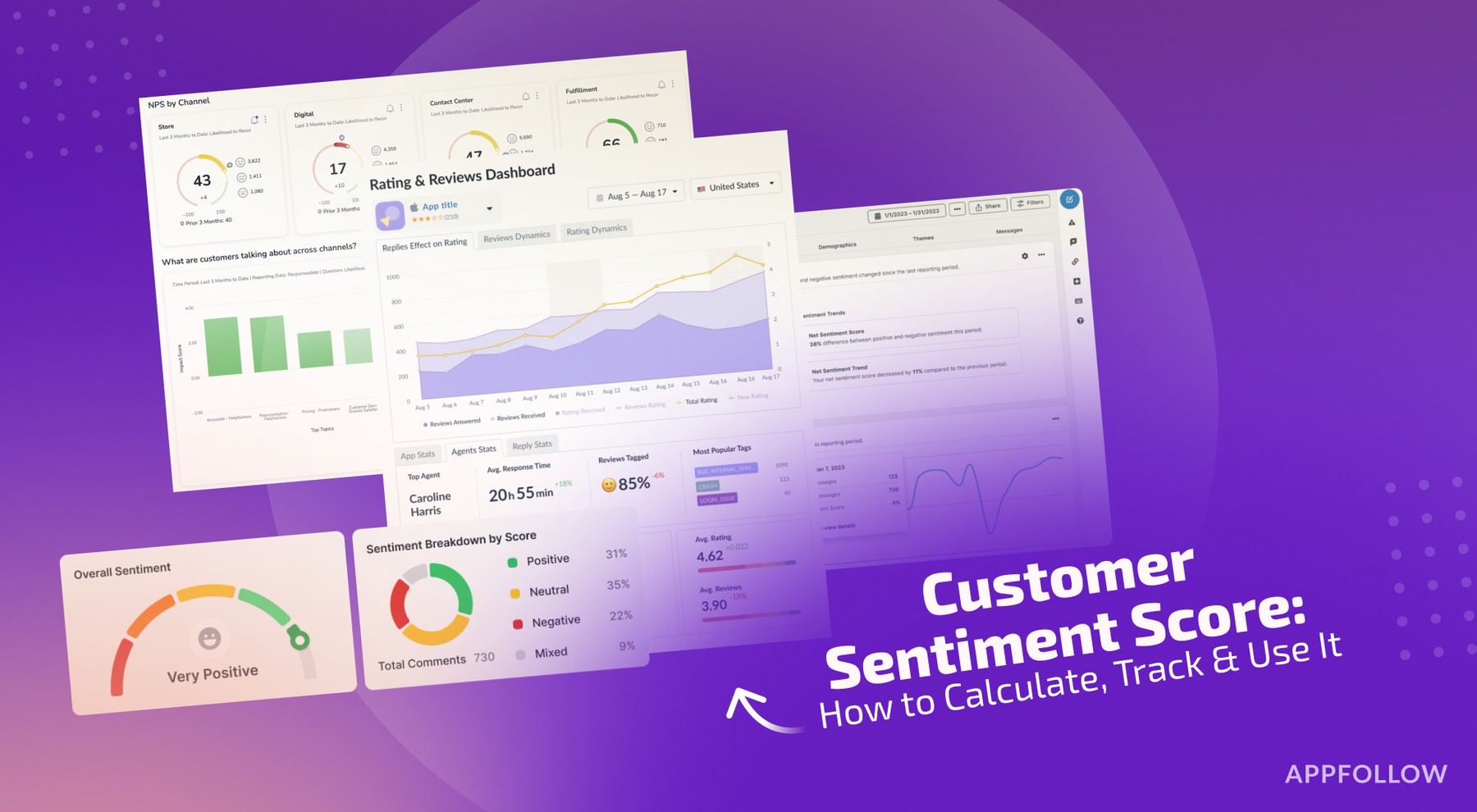
Ratings & Reviews performance provides an overview of what users think of your app. Here are the key metrics to help you identify how your app is rated by users and how successful is your review management strategy.
Pix4Dcatch is the tool for acquiring optimal ground images for photogrammetry. These ground images can be used to get highly accurate 3D models on Pix4Dcloud or offline within Pix4Dmapper (free 15 day trial available, then a valid subscription is required). No need to be an expert. Walk around your area of interest and the app will record pictures along the way, together with GPS positions. Using augmented reality, get live feedback on the covered area and the completeness of the scan thanks to the overlaid 3D mesh on the current video frame that is available for devices with LiDAR sensors. Images can be uploaded to Pix4Dcloud for the fast generation of scaled and georeferenced 3D models and point clouds that you can visualize, measure, share, and export. Or they can be exported locally for processing in Pix4Dmapper. Workflow 1 - Scan: Walk around the area of interest. Pix4Dcatch automatically records geotagged frames and displays on your screen real-time 3D meshing for scene completion feedback. 2a - Upload: Stop recording and automatically upload images to Pix4Dcloud to generate accurate and easy to share 3D models (requires a Pix4Dcloud subscription - free 15 day trial available). 2b - Or export: transfer the images from your device to your desktop computer and start the photogrammetry process, add GCPs and validate the accuracy of your 3D scene (requires a Pix4Dmapper subscription - free 15 day trial available). 3 - Examine: Measure distances, areas, and volumes, and perform virtual inspections. 4 - Share: Selectively and securely share project data and insights with your team, clients, and suppliers. Devices compatibility: • Optimized for LiDAR equipped devices • All ARKit enabled devices • viDoc RTK Usage information Ensure the app is up to date. Upload the images to Pix4Dcloud to generate, visualize, measure and share your 3D model. Pix4D accepts no liability for damage, injuries or legalities from the misuse of this app. Use only in safe environments.