Ratings & Reviews performance provides an overview of what users think of your app. Here are the key metrics to help you identify how your app is rated by users and how successful is your review management strategy.
User reviews affect conversion to installs and app rating. Featured and helpful reviews are the first to be noticed by users and in case of no response can affect download rate.
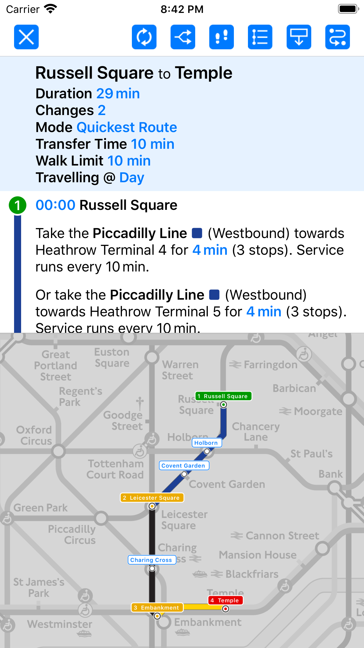
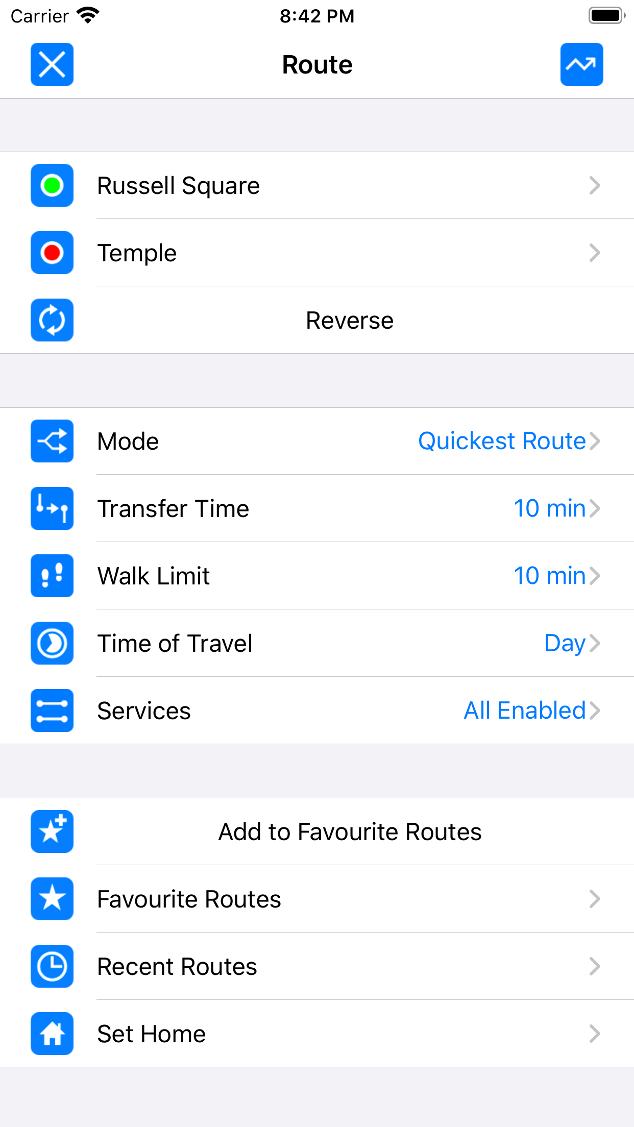
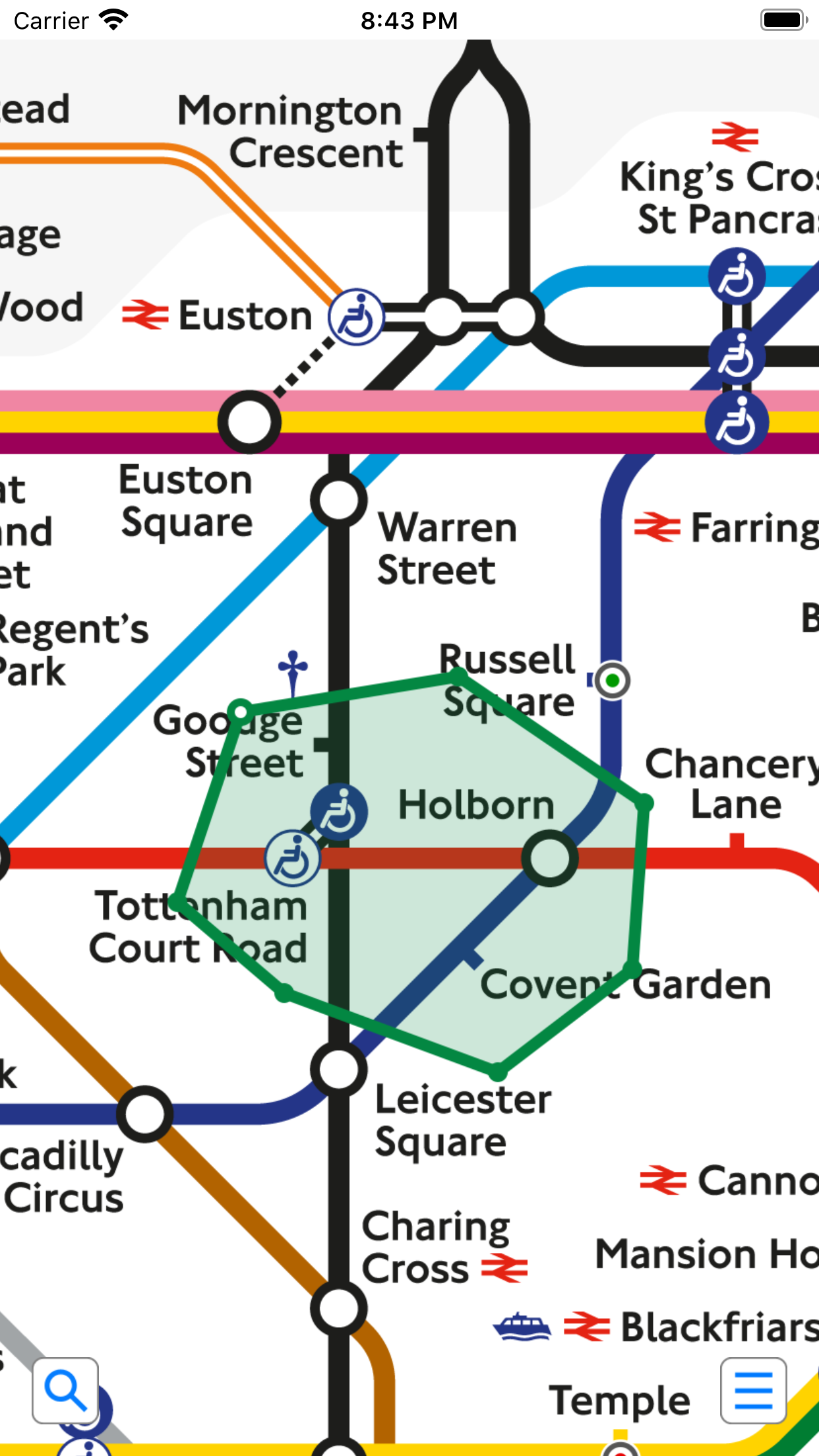
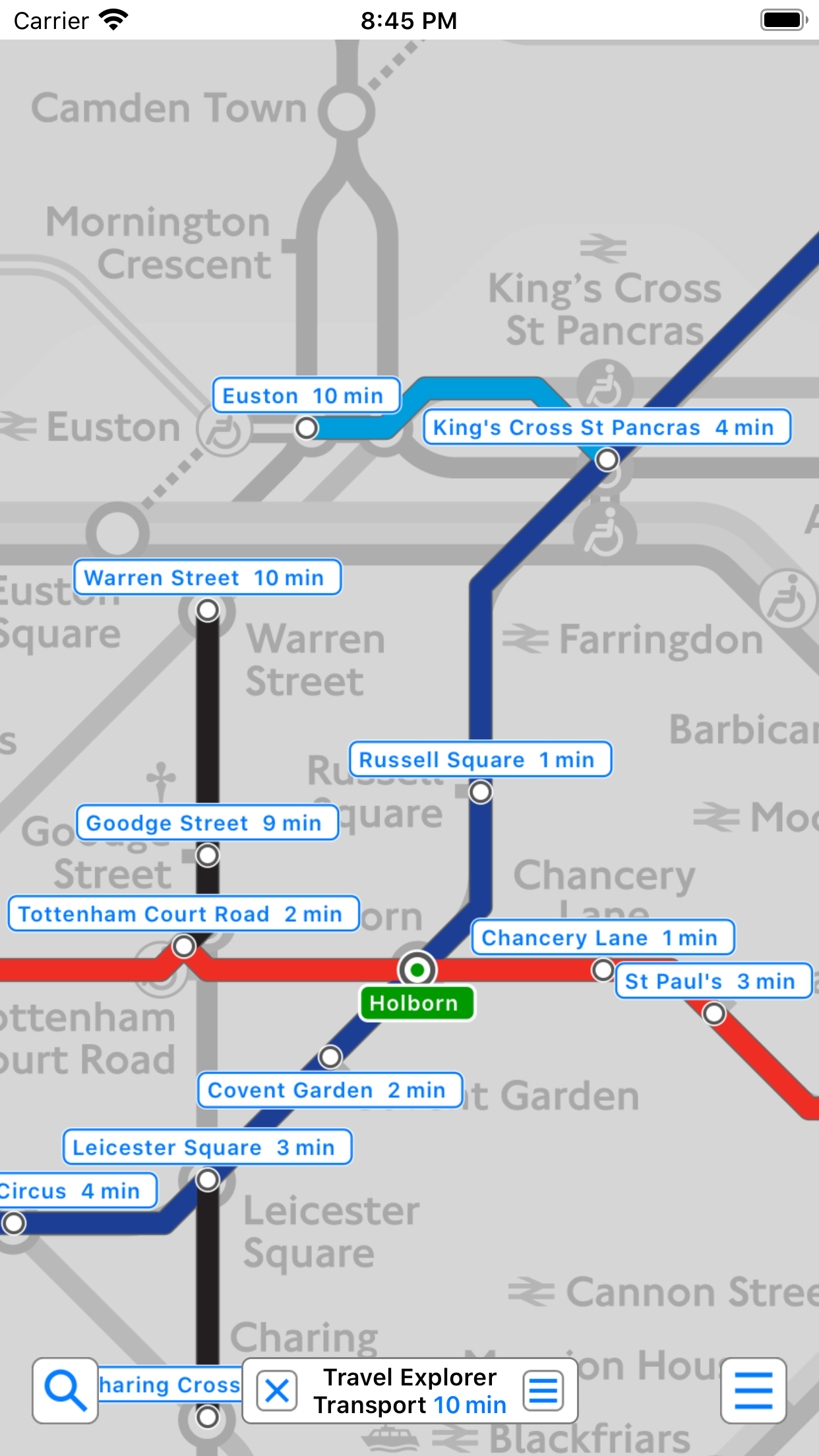
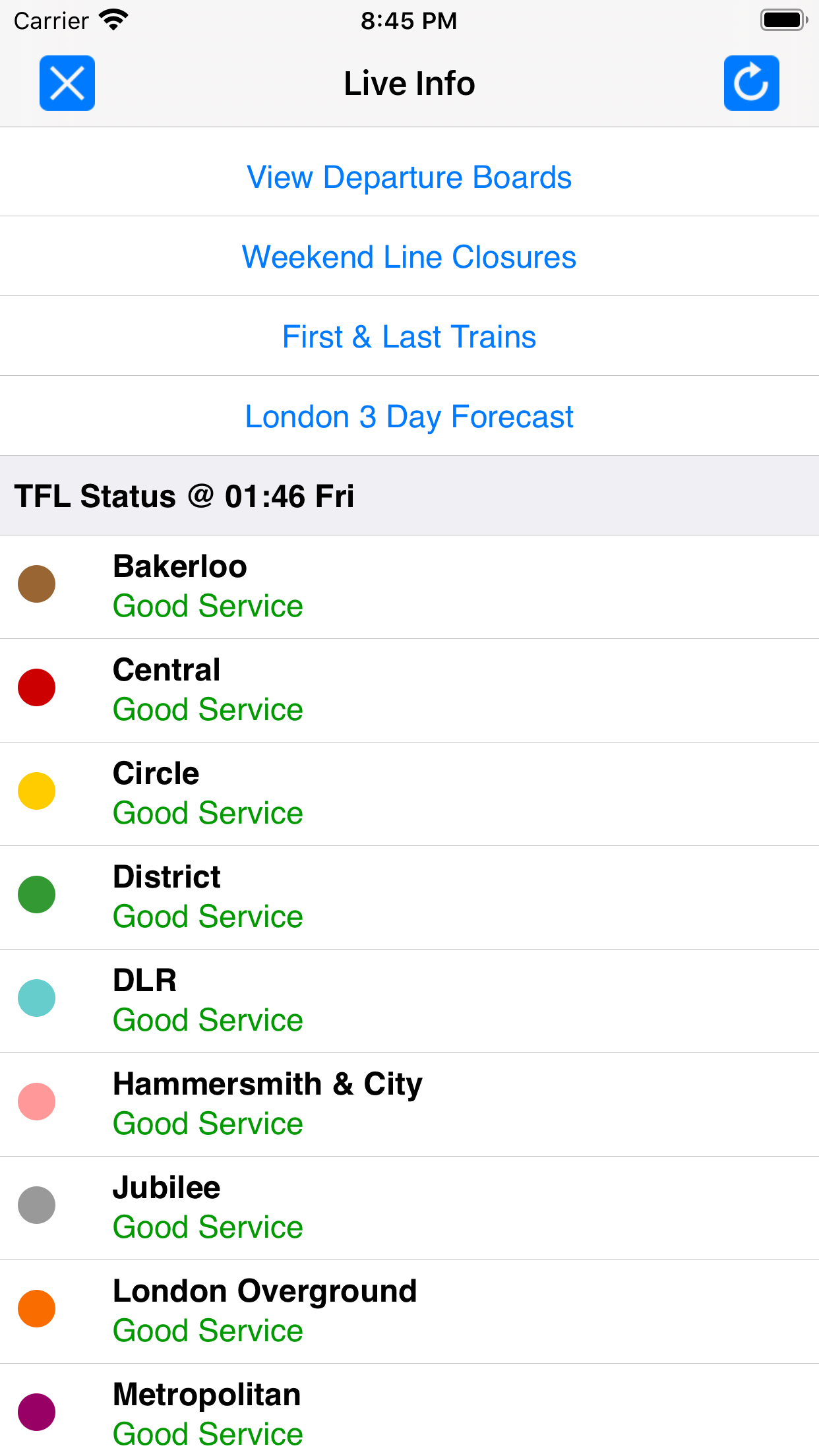
"Probably the best map and route planner out there" - recent customer review Don't take our word for it, join over 1 million users who rely on this app daily. ● TRAVEL AT NIGHT ● ● Now contains routing for the latest TfL night services. ● KEY FEATURES ● ● Simple, fast and easy to use. ● Designed for the first time visitor and experienced commuter. ● Unique "Travel Explorer" feature provides a view of travel times and distances from any location on the map. ● Latest official TfL (Transport for London) map. ● Saves and recalls favourite and recent journeys. ● Online street map integration (when an internet connection is available). ● Services can be turned on or off, routing around problems. ● Easily locates your nearest transport stop. ● Places of interest, parks etc are built in to the application. ● Ability to mark up the map with favourite locations and areas. ● OVERVIEW ● The London Underground application is a superb route planner for the London Underground system with many unique features. The inbuilt map provides the official view of the city underground services with the ability to switch to an online street map view when an internet connection is available. This way the user can view the online map feature when above ground and the transport map and route planning is still fully functional underground or anywhere there is no internet connection. ● TRAVEL EXPLORER ● The unique travel explorer feature provides a view of travel times and distances from any location on the map. This is helpful for getting a sense of scale and connectivity of the transport system and can provide some interesting results. For example is it quicker to use the tube to go from Covent Garden to Tottenham Court Road or is it quicker on foot? (Hint, the quickest route will keep you fitter). No other application makes it so easy to get around on the tube and allow you to make travel decisions based on the actual distances and travel times on foot. ● ROUTING ● Does not require an internet connection and will always be available to display a clear and detailed view of the city transport system, plus list and animate the optimum route for your journey. Provides the fastest route calculations of any mobile routing application (virtually instantaneous) using actual published journey times with the ability to select the quickest route or the route with the least changes. Comprehensive details of your planned route are provided, including changes, directions of travel, number of stops, predicted journey times, etc. Uniquely this application gives you “direction”, “towards” and “service frequency” information (not available on any other offline journey planner) for example “Take the Northern line (Southbound) towards Stockwell for 10 mins (6 stops). Service runs every 7 minutes” which is essential when finding the correct platform and connection. Also given are alternatives for each leg of the journey. ● NO INTERNET CONNECTION REQUIRED ● The map and routing do not require an internet connection and you will not be charged data connection fees. This also means the application runs perfectly underground, on an aeroplane, etc. For international visitors to a city who have data roaming turned off this is an ideal solution. ● LIVE INFO ● When an internet connection is available, optional "Live Information" on the current state of the transport services and real time station departure boards can be viewed allowing you to plan your journeys in advance and avoid any potential delays. ● MORE MAPS ● This map is one in a series of Zuti worldwide city maps, if you like this product you may also enjoy some of our other offerings, please visit www.zuti.co.uk for further information. This is the promotional version of the application, please see the app store for the advert free version. ● NOTE ● Please note this is the free promotional (Pro) version and does contain advertising.