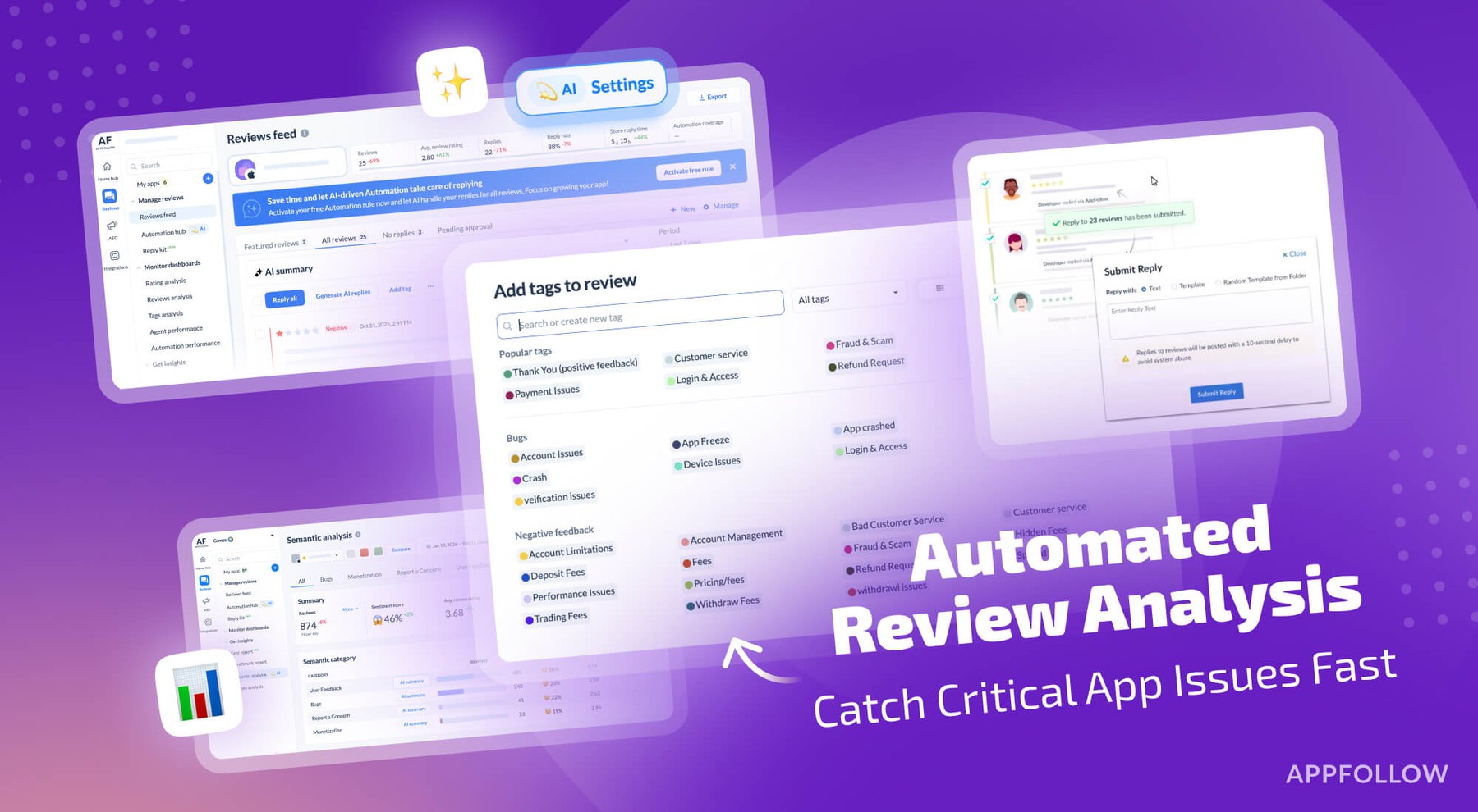
Ratings & Reviews performance provides an overview of what users think of your app. Here are the key metrics to help you identify how your app is rated by users and how successful is your review management strategy.
GPS Fields Area Measure lets you accurately calculate distance, perimeter and area — even without internet. Mark any point with notes, photos or custom data. Ideal for crop scouting, equipment tracking, land surveys or issue logging. Designed for: • Farmers & agronomists (field mapping, crop scouting, fertiliser & spray planning) • Land surveyors & construction (fencing, irrigation layout) • Property teams (map parcels and store notes, photos & site info) Key Features: • One-tap GPS walking/driving measurement • Precise manual editing with point markers • Add notes, photos & custom objects • Fully offline — works anywhere • Save, organise & edit projects • Export to KML, KMZ or Shapefile • Add custom map layers — drone imagery, raster maps or any WMS service • Elevation profiles & built-in compass What our users say: “Best measuring app I’ve ever used. Replaced my expensive handheld GPS.” — James, London “Perfect for remote areas with no signal.” — Hannah, Manchester “Great for property surveys. All my notes, photos and boundaries in one app.” — Oliver, Bristol 4.6 stars from 11,000+ users • Used in 150+ countries • Regular updates Download free. Unlock Premium for advanced tools and cloud storage. • Privacy policy: https://privacy.farmis.com/ • Terms of Use: https://privacy.farmis.com/


![How to measure customer sentiment for app reviews [7 metrics]](https://cdn.appfollow.io/blog/static/appfollow_1335e02d-b0b3-49f7-9eb6-94171dc7e379.jpg)