Ratings & Reviews performance provides an overview of what users think of your app. Here are the key metrics to help you identify how your app is rated by users and how successful is your review management strategy.
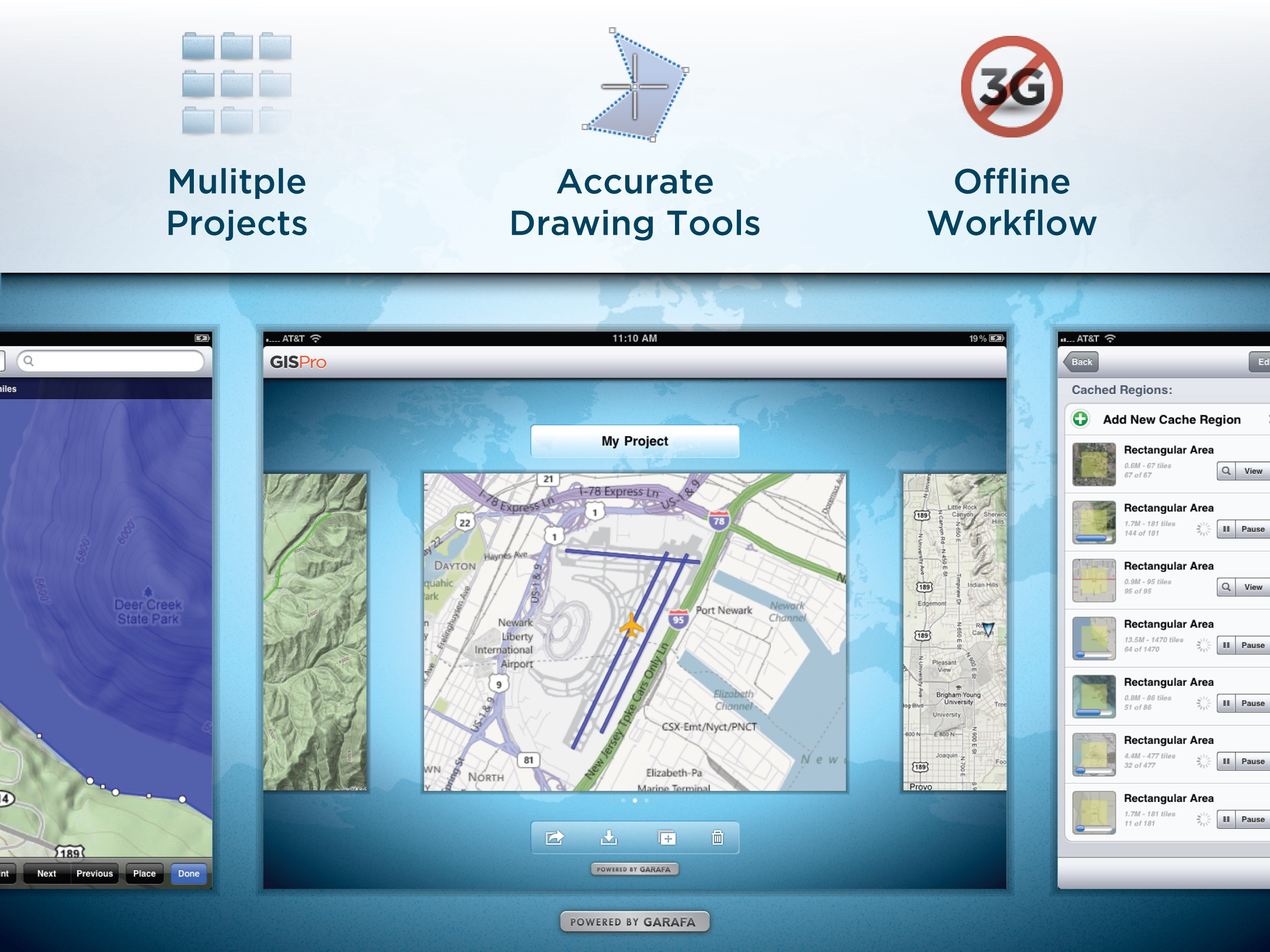
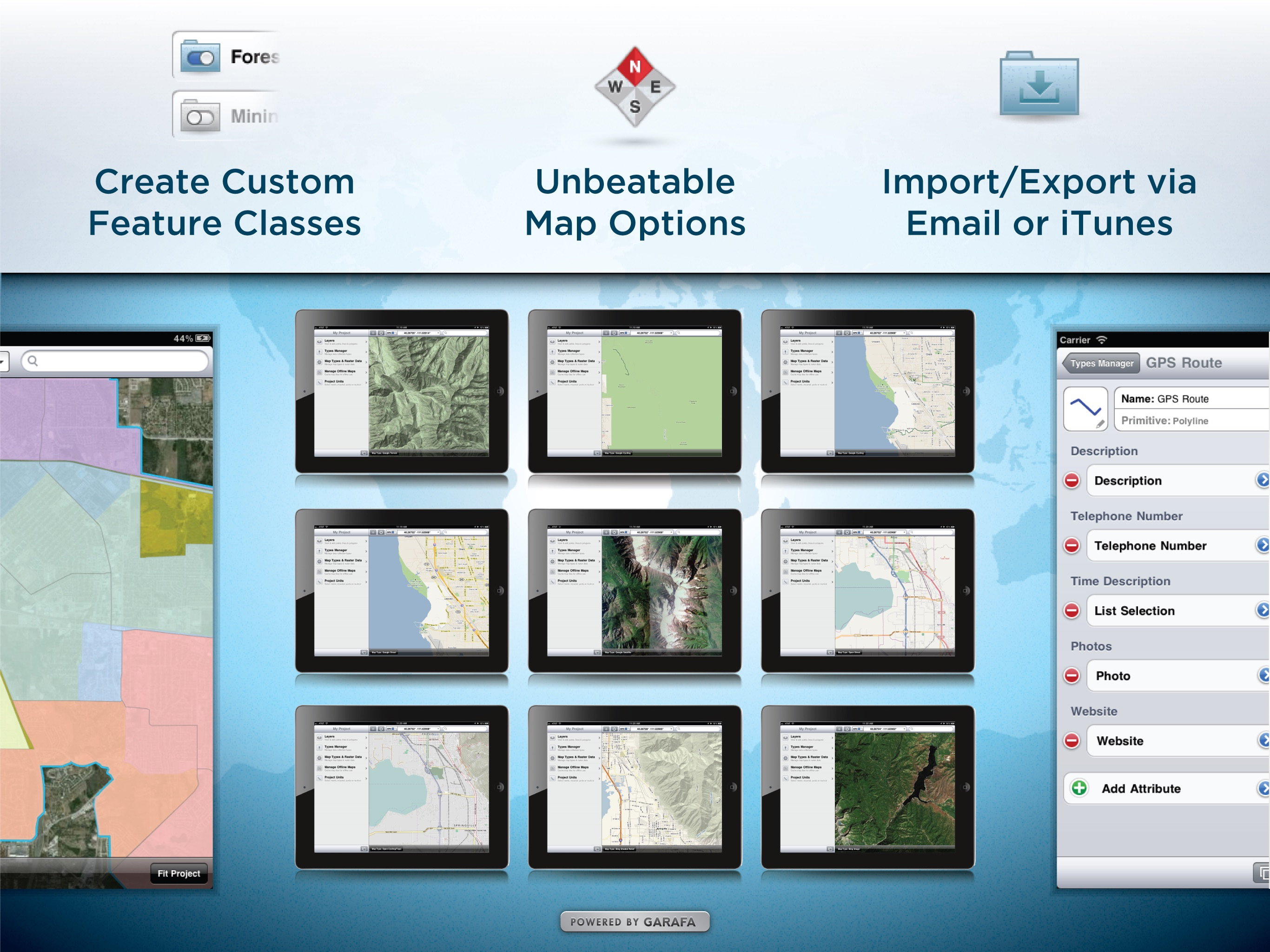
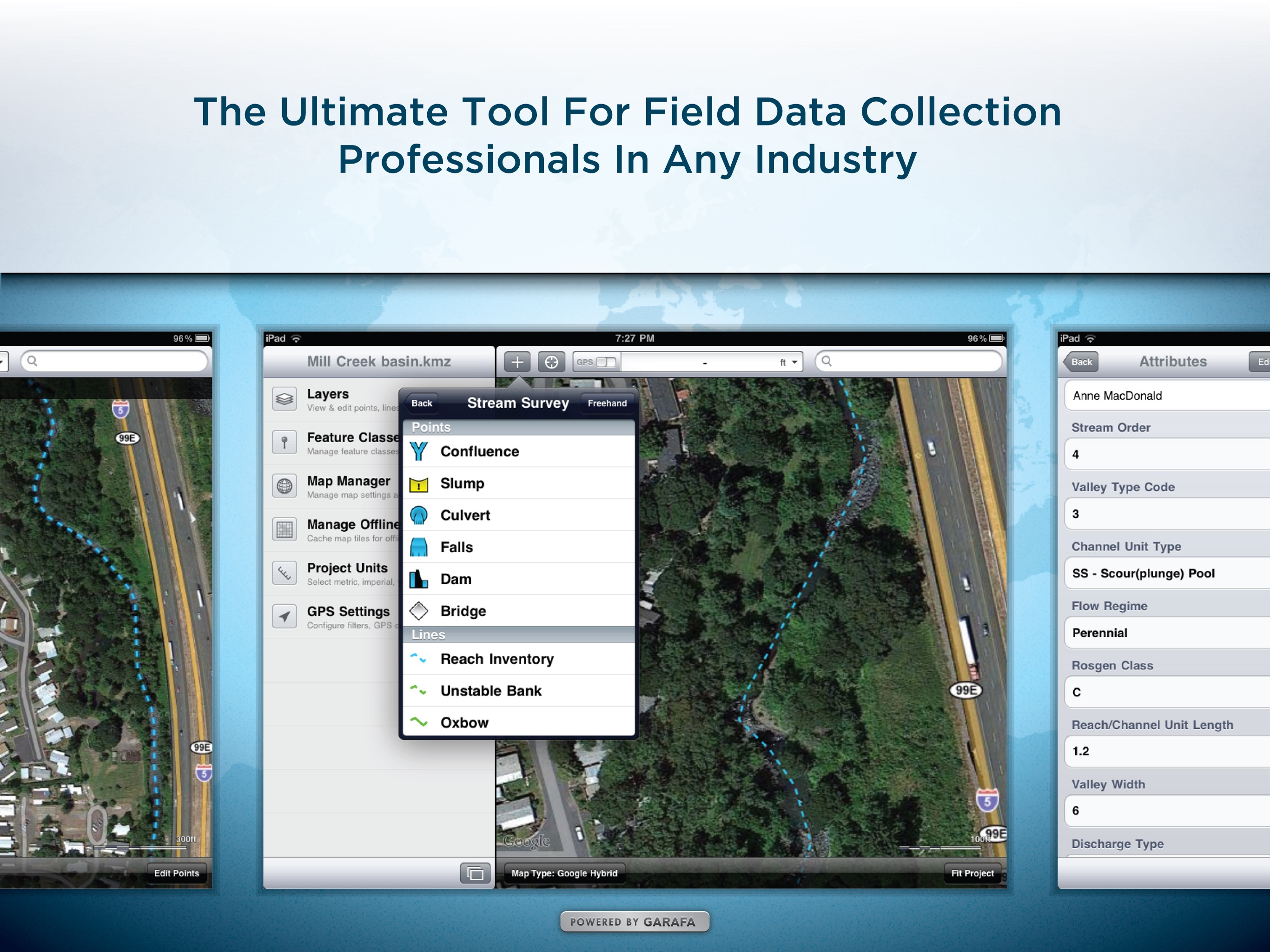
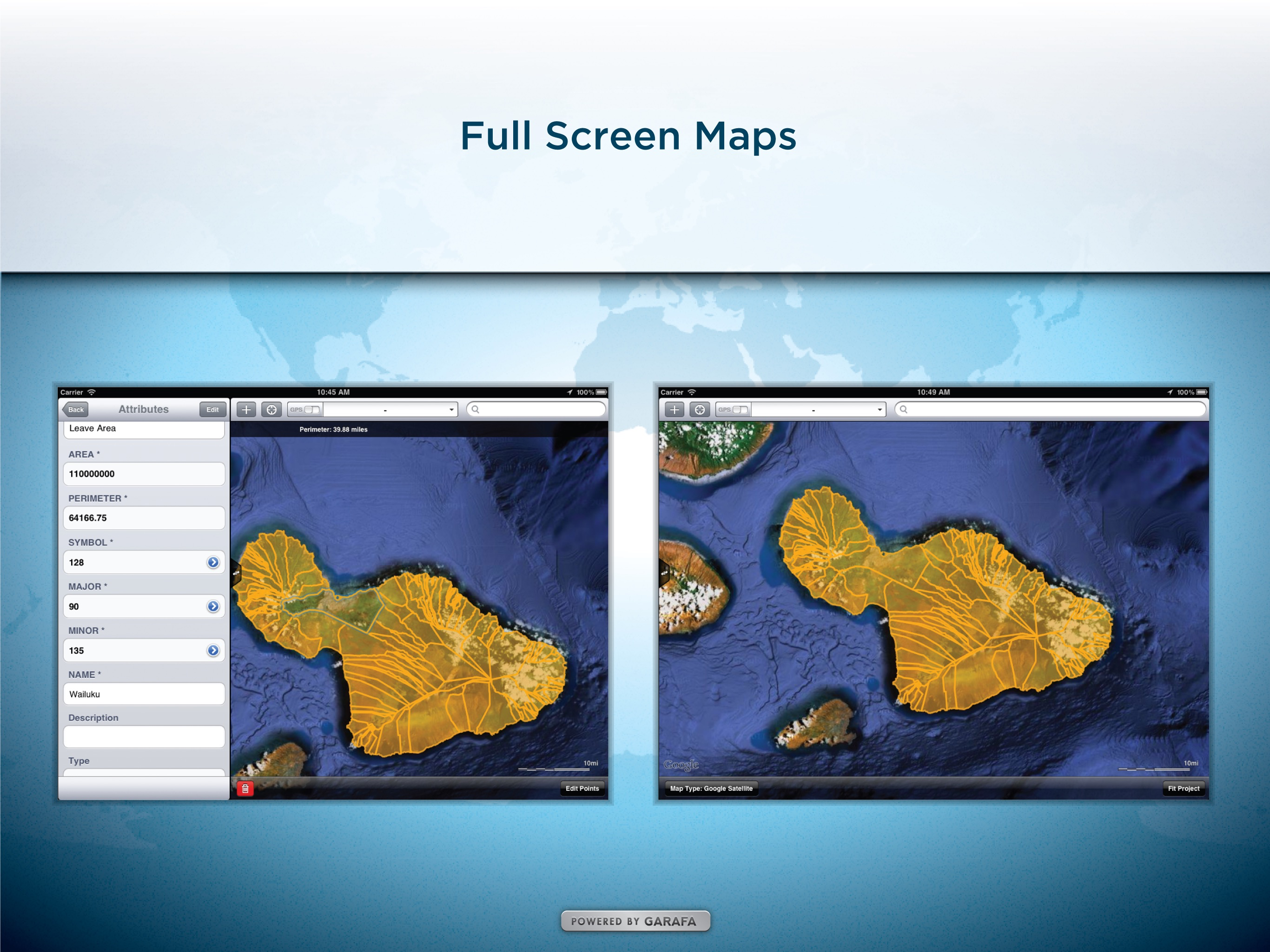
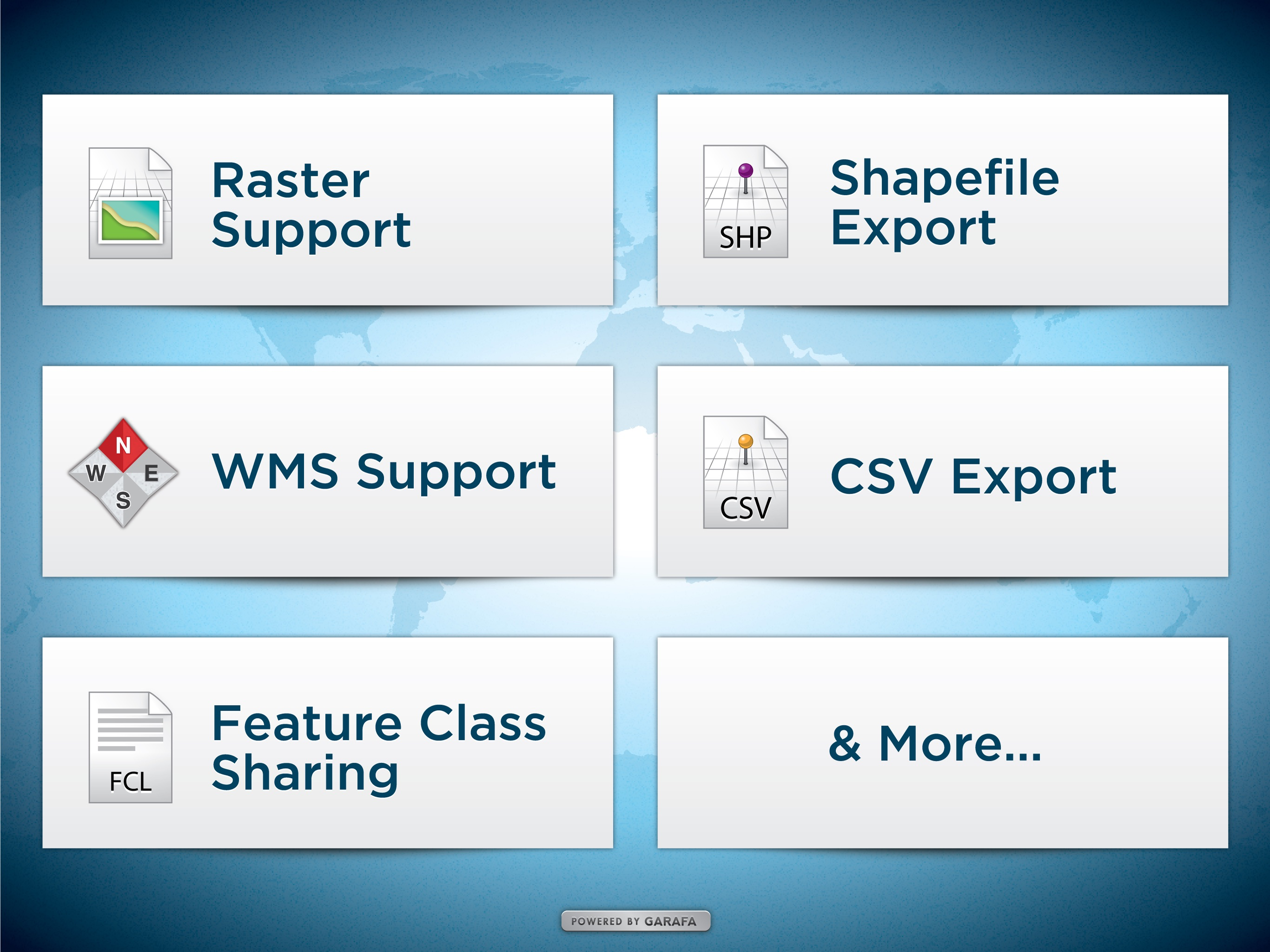
Premier field collection and data viewer for iPhone and iPad. GIS Pro is the enterprise version of a two part app suite for mobile GIS users. GIS Kit ($99) is geared toward individual users whereas GIS Pro ($299) is capable of some more advanced, collaborative features that are typical of an enterprise environment (see list below). FEATURES IN GIS KIT & GIS PRO - No desktop GIS software required. - No prior GIS training required. - Completely offline capable. - Cache (download) open source topographic maps, street maps and satellite imagery straight from device. - Import ESRI Shapefiles and KML/KMZ files including attributes. - Attribute/form fields include: Alphanumeric (Description), Photos, numerical values, user defined list of values, addresses, websites, date & time, telephone number, check box. - Easily collect new point, line, and polygon features in the field by GPS or drawing manually. - Enter attribute values for each feature and/or add new attribute types at time of collection. - Create templates of user defined feature classes with custom attributes. - Comes loaded with numerous example feature templates for professional use in Forestry, Wetland Delineation, Stream Surveys, and Real Estate. - Import and export data wirelessly by email. Larger data sets can be imported/exported by connecting to any computer with itunes. - Filter the GPS based data collection by controlling the amount of GPS points by distance, time or accuracy - Organize by projects and layers - Best-in-class performance. Tested on iPad 2 with over 1 million point features! FEATURES ONLY IN GIS PRO - Raster imagery import & export (GeoTIFF, Worldfile, KML, and even non-spatially referenced images can be imported with in-app 3-point registration) - Export Shapefiles and CSV files via email or USB with iTunes - Export, share, and import custom feature class templates with other devices used by your team so there are no conflicts with your features and their attributes. - Basic WMS for additional basemap options - Easily convert Shapefiles to KMZ files and vice versa Documentation and videos can be found using the support link. IT MANAGERS Please note that a separate license is required for each user or each device that is used by multiple users. See http://www.apple.com/legal/itunes/us/terms.html for details. Also see http://www.apple.com/business/vpp for information on purchasing in volume. Continued use of GPS running in the background can dramatically decrease battery life.

![12 Best Customer Review Management Software We Love [Pros & Cons]](https://cdn.appfollow.io/blog/static/appfollow_d9043069-73ed-45a4-8ab4-b7a90b92006b.jpg)