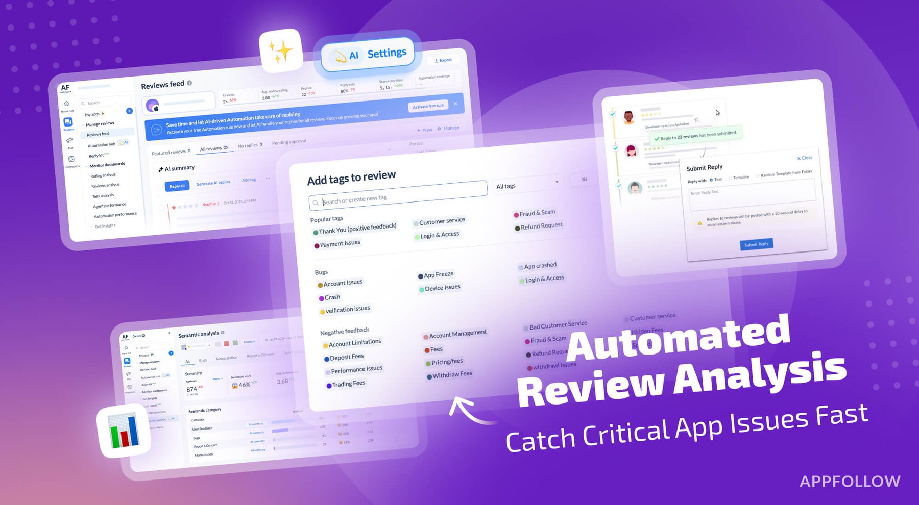
Ratings & Reviews performance provides an overview of what users think of your app. Here are the key metrics to help you identify how your app is rated by users and how successful is your review management strategy.
User reviews affect conversion to installs and app rating. Featured and helpful reviews are the first to be noticed by users and in case of no response can affect download rate.
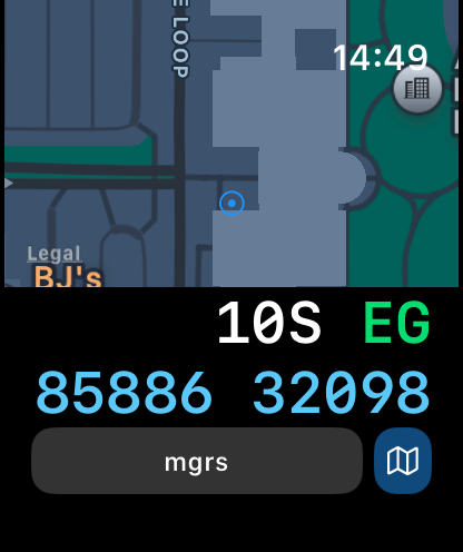
Coordinates is a powerful and user-friendly tool for anyone working with geographic locations — from travelers and surveyors to engineers and GIS professionals. Instantly view, convert, and manage coordinates in a wide range of global formats and datums, all within a clean and intuitive interface. Whether in the field or at the desk, Coordinates is your all-in-one solution for precise location work. # User-friendly Design Your current location is displayed at the intersection of two grey lines, with clear latitude and longitude readouts. You can manually set the location using map taps, coordinate input, or place search. Intuitive buttons give quick access to measurement tools, map layers, location bookmarking, shape drawing, and annotation — all from a clean, compact interface. # Various Coordinate Formats Supports formats like UTM, MGRS, Georef, and more alongside Longitude/Latitude. # Batch Converter Quickly convert multiple coordinates or files in one streamlined action. # Rich Object Details Add notes, photos, and media to any saved object — pins, shapes, or measurements — to keep your data organized and context-rich. Easily share your saved content across devices using backup and export tools. # Datum Conversion Transform coordinates using EPSG, ESRI, and IAU2000 references. Supports X/Y, geodetic, and projected systems. # PROJ.4 Calculator Convert coordinates between systems using the PROJ.4 library, with support for datum shifting and custom projections. # Navigation & Tracking Real-time bearing and distance updates are provided with a large coordinate readout, ideal for on-the-field usage. # Speedometer Track your current speed in real time. # Unit Converter Convert 40+ unit types (distance, pressure, radiation, etc.) # Signal Board Send big bold messages on-screen # Elevation Support Altitude data is available for land areas. # Import / Export - .gpx .geojson .kml file supported # Distance, Bearing & Area Mark points or draw lines to measure distance, bearings, and area. # Offline Map Tiles Download tiles for offline use. Pick a city or define your own area. # Custom Map Tile Selector Choose from Apple Maps, OSM, or add your own tile server with {z}/{x}/{y} format. # Supported Input / Output # Latitude and Longitude DD/DM/DMS Standard UTM NATO UTM MGRS / USNG Georef QTH Locator / Maidenhead (WGS84) World Mercator (WGS84) Web Mercator Geohash what3words Global Area Reference System (GARS) Ordnance Survey National Grid [BNG] OSGB36 ISO 6709 Natural Area Code Irish Grid Reference / Coordinates Plus Code (Open Location Code) Mapcode Dutch Grid ECEF Indian Kalianpur 1975 Open Postcode Geohash-36 Guatemala GTM RT90 SWEREF99 Indian 1975 QND95 / Qatar National Grid IRENET95 / Irish Transverse Mercator KOSOVAREF01 HD 72 / EOV Kertau (RSO) / RSO Malaya Timbalai 1948 / RSO Borneo EST97 Estonian 1997 LKS92 / Latvia TM NZGD49 NZGD2000 CH1903/+ GGRS87 ETRS89-extended / LAEA Europe NTF (Paris) / Lambert zone II French DFCI Grid ARINC 424 FMS ARC1950 Pulkovo 1942 / SK42 PZ-90 H3 Placekey GDM2000 JGD2011 KUDAMS/KTM World Magnetic Model / WMM 2015/WMM 2015v2 Search by name Photo metadata Proj.4 formats Street Address # Subscriptions # “Coordinates – GPS Converter” including most of its features, is completely FREE to use. You can subscribe to this application to remove ads Price may vary by location. Payment for subscriptions will be charged to your iTunes Account at confirmation of purchase Subscription automatically renews unless auto-renew is turned off at least 24-hours before the end of the current period. Subscriptions may be managed by going to your iTunes Account Settings after purchase or by clicking the “Purchase / Manage Subscription. Auto-renewal may be turned off by going to Account Settings after purchase. Subscription cannot be cancelled during the active subscription period Privacy policy: https://mapnitude.com/privacy-policy Terms of use: https://mapnitude.com/terms-of-service


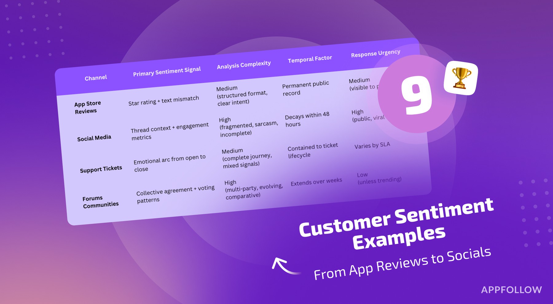
![How to measure customer sentiment for app reviews [7 metrics]](https://cdn.appfollow.io/blog/static/appfollow_1335e02d-b0b3-49f7-9eb6-94171dc7e379.jpg)