AFIS Wildfire Map
source

AFIS Wildfire Map

Price
Free
Category
Weather Utilities
Last update
Aug 12, 2021
Publisher
View in store
Loading...

Ratings & Reviews performance

Ratings & Reviews performance provides an overview of what users think of your app. Here are the key metrics to help you identify how your app is rated by users and how successful is your review management strategy.

Loading...

Description

655 chars

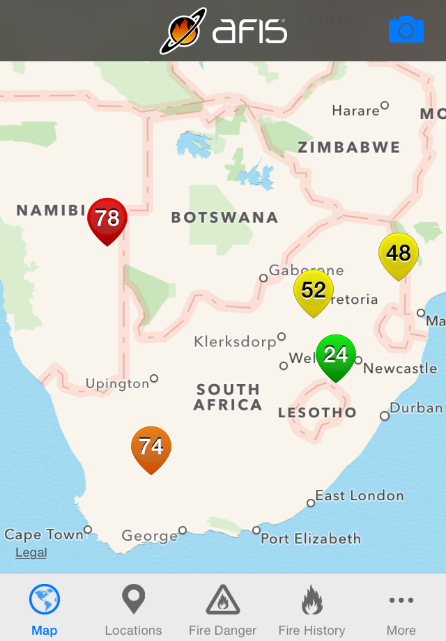
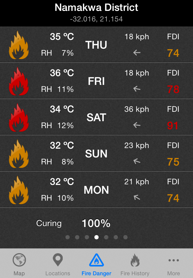
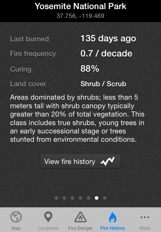
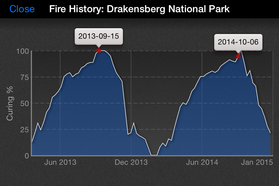
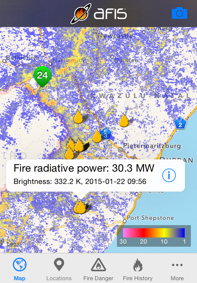
Get the latest updates on wildfire locations with the CSIR's AFIS Wildfire Map app that puts vital wildfire information at your fingertips. AFIS gives you access to fires detected globally by NASA's Terra and Aqua satellites as well as the SNPP and NOAA-20 satellites. This app provides native access to the AFIS Viewer that is available online at https://viewer.afis.co.za/ This app replaces the previous AFIS app that was no longer maintainable. New features will be added over time. Visit the South African Council for Scientific and Industrial Research (CSIR) website for more information about the organization behind AFIS: https://www.csir.co.za

Screenshots

https://is2-ssl.mzstatic.com/image/thumb/Purple114/v4/d6/a4/39/d6a4390b-b8be-d418-165d-306cc60a496e/pr_source.png/640x920bb.pnghttps://is3-ssl.mzstatic.com/image/thumb/Purple124/v4/01/59/4f/01594fe3-8eca-814b-d1ce-a23cee327707/pr_source.png/640x920bb.pnghttps://is3-ssl.mzstatic.com/image/thumb/Purple114/v4/16/d6/4e/16d64e7b-619a-03c1-74ec-dd87e11dfccd/pr_source.png/640x920bb.pnghttps://is2-ssl.mzstatic.com/image/thumb/Purple114/v4/51/fa/3d/51fa3d24-a87e-0565-c2bd-338cb1b67ad7/pr_source.png/960x640bb.pnghttps://is2-ssl.mzstatic.com/image/thumb/Purple114/v4/9d/68/57/9d6857e5-33ea-fb7c-a3f5-66e8494ffeda/pr_source.png/640x920bb.png
Loading...
Loading...

Find growth insights on our blog

React to user feedback and market trends faster