Ratings & Reviews performance provides an overview of what users think of your app. Here are the key metrics to help you identify how your app is rated by users and how successful is your review management strategy.
User reviews affect conversion to installs and app rating. Featured and helpful reviews are the first to be noticed by users and in case of no response can affect download rate.
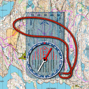
Topographic map of the world with no limitations: • View and cache topographic tiles and satellite imagery • Cache all topographic tiles in a visible region (for offline availability) • Add unlimited map markers • Measure distance (in a straight line) between multiple points and markers • Import / export GPX and KML waypoints, tracks and routes • Record routes • Search for places of interest (supports decimal coordinates) • Battery conscious (for those that can't recharge every day) • Space conscious (for those that don't have gigabytes to spare; external SD card support) • Stay up-to-date (delete / refresh the cache, no waiting for application updates) • Navigate with Google Maps interactions (pinch zoom, scroll, rotate, drop marker, drag marker etc) • Fully functional for free! (no subscription, lite or pro versions required) World Topo Map is intended for outdoor enthusiasts who want to mark locations visited, create markers to visit, follow imported tracks or create their own. It's designed to be lightweight, intuitive, responsive, battery conscious and totally free. Perfect for casual day trips to serious bush excursions. Developed by an adventurous person for adventurous people! Topographic Map Tiles OpenTopoMap is a free, topographic map generated from the data in the OpenStreetMap and SRTM elevation data. This service provides excellent topographic coverage of most of the globe, however there may be areas and zoom levels with no topographic information. OpenTopoMap is licensed under CC-BY-SA (opentopomap.org) Analytics World Topo Map uses Google Analytics to anonymously send application metrics to measure stability of the app. No personal information is sent, used or disclosed. For further information about Google Analytics, see http://www.google.com/analytics. For details of the Google Analytics Privacy Policy see http://www.google.com/policies/privacy By downloading this app, you agree to the use of analytics.


![13 Examples On How To Get More App Reviews In 2025 [Copy/Paste Templates]](https://cdn.appfollow.io/blog/static/appfollow_75995ad7-7d6f-40c1-81d4-ea3d1fe68258.jpg)

![50 positive review response examples [+15 negative cases]](https://cdn.appfollow.io/blog/static/appfollow_72e0920a-1a85-45f2-8567-5f1caecc4c00.jpg)