Ratings & Reviews performance provides an overview of what users think of your app. Here are the key metrics to help you identify how your app is rated by users and how successful is your review management strategy.
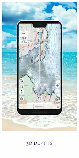
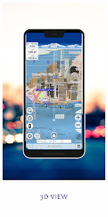
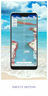
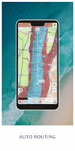
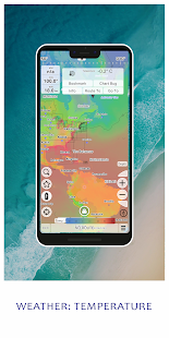
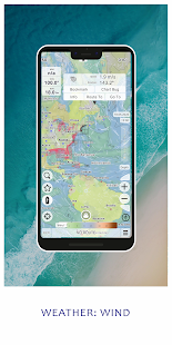
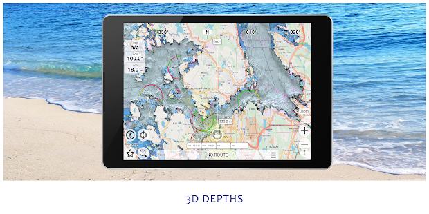
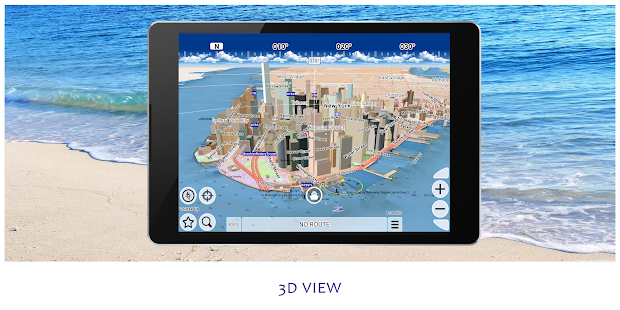
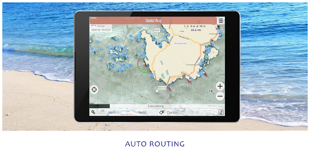
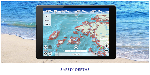
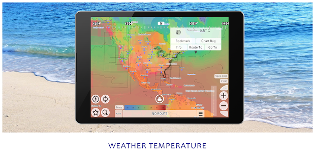
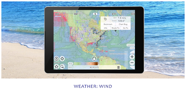
mKart is easy to install and use online marine navigation software (from creators of ECS/ECDIS dKart Navigator) with the fastest chart engine using hybrid ON/OFF sea maps concept and 3D nautical charts. Product Highlights: FREE MARINE MAPS: Online nautical charts are being installed automatically via Internet by customer’s position or while browsing and stored for off-line use. No action is required from users side, updating is performed in the same way. Currently only ENC NOAA charts available, other free nautical maps will be added a bit later. OSM AND 3D MARINE CHARTS: OSM and 3D marine charts are uploaded and displayed automatically in areas when available. 3D buildings, ships and infrastructure contribute to better seafarers orientation and awareness. S57/S102 MARINE CHARTS: - Estonia Marine Charts - Norway Marine Charts MARINE ROUTE PLANNER: Save time while boat navigation with integrated sea and river auto routes functionality. Safety checks is implemented along with route monitoring functionality and warning system. 3D BATHYMETRY MAPS: 3D is not a game, make use of increased ‘look ahead‘ without zooming. Increased situational awareness in complicated situation. Use 3D sea bottom feature on your marine chartplotter for better performance. SAFETY AREAS: Display safety area on the chart plotter is filled up graphically on the sea map by only safe depth. Safety zone is calculated trough 3D sea bottom model. MARINE TRAFFIC: Marine traffic data can be obtained from open AIS streams over Internet to display and identify dangerous targets. COMPASS MODE: Get a quick look around while boat navigation with advanced VR option for better orientation and using visual aids for navigation effectively. SEARCH: Search all objects and information on ENC S-57 charts trough SW and data via universal search function. MARINE WEATHER: mKart online services allows to deliver highly detailed weather information directly to the marine chartplotter.