Ratings & Reviews performance provides an overview of what users think of your app. Here are the key metrics to help you identify how your app is rated by users and how successful is your review management strategy.
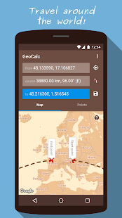
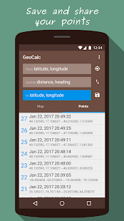
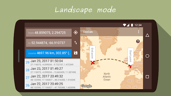
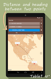
GeoCalc calculates geographical coordinates given a start point, distance and heading, or, calculates the distance and heading between two points. The calculated coordinates can be set as the initial coordinates, allowing fast consecutive calculations. GaoCalc may be used for roadbook off-road racing, hiking, sailing, orienteering, geocaching, questing, treasure hunting, hobby flying, for education, for fun, or anyone needing to calculate bearings and distances between coordinates. Calculations are performed using an accurate ellipsoidal model of the Earth's surface. FEATURES: - Calculate coordinates of a point, given a start point, heading and distance - Calculate heading and distance between two points - Show points on map - Use coordinates from current GPS position - Coordinates as decimals or DMS - Metric, imperial or nautical units - Save all calculated points - Share saved points


![13 Examples On How To Get More App Reviews In 2025 [Copy/Paste Templates]](https://cdn.appfollow.io/blog/static/appfollow_75995ad7-7d6f-40c1-81d4-ea3d1fe68258.jpg)

![50 positive review response examples [+15 negative cases]](https://cdn.appfollow.io/blog/static/appfollow_72e0920a-1a85-45f2-8567-5f1caecc4c00.jpg)